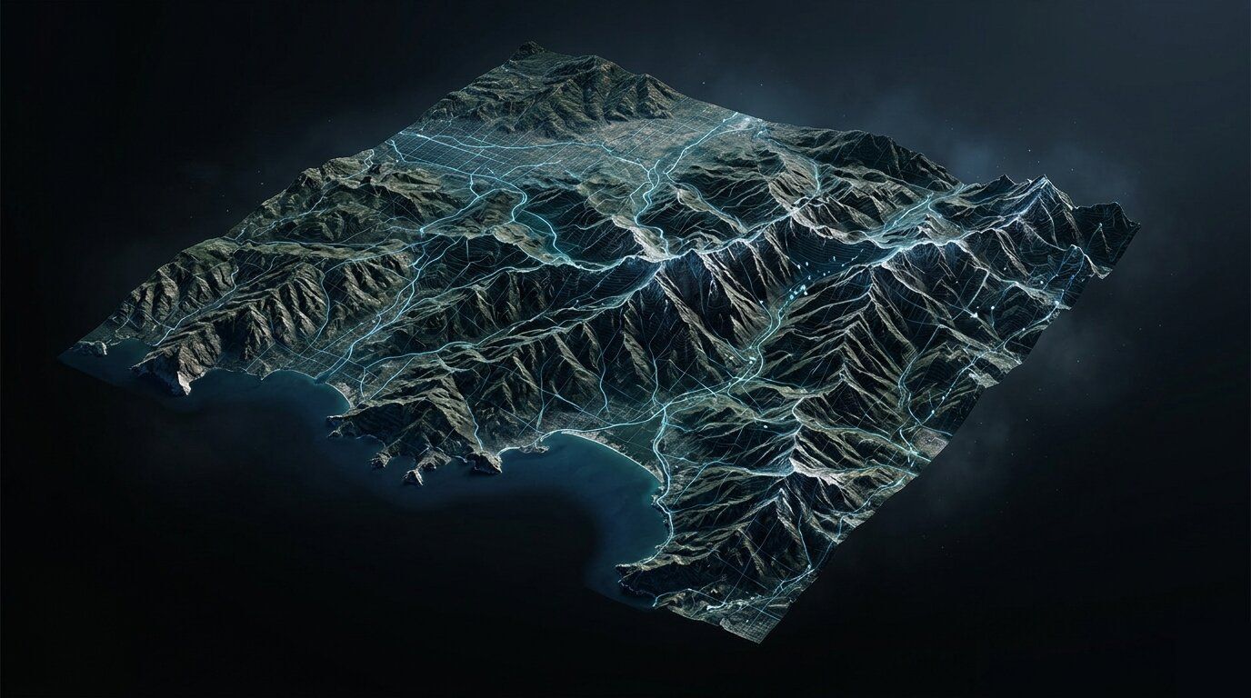
What Geodata Layers Does Atoll (or Planet) Expect for Accurate 5G Propagation?
Forsk Atoll and InfoVista Planet require DTM, LULC clutter, DSM/clutter heights, and 3D building vectors for accurate 5G propagation. Learn exactly...
Explore in-depth articles, real-world use cases, and expert insights on geospatial intelligence, 3D data, and digital terrain modeling. Discover how high-quality data and advanced analytics support smarter planning, improve operational efficiency, and enable better decision-making across industries.
Forsk Atoll and InfoVista Planet require DTM, LULC clutter, DSM/clutter heights, and 3D building vectors for accurate 5G propagation. Learn exactly...
Building height data for RF planning is extracted via airborne LiDAR, aerial photogrammetry, or satellite AI. Discover the accuracy, cost, and...
LiDAR delivers exceptional accuracy for telecom RF planning but is only cost-effective for small, high-precision areas. Discover when LiDAR is...
High-resolution 3D geodata reduces corrective site visits, drive test requirements, and field survey costs in 5G network deployment. Discover how...
2D clutter data is no longer sufficient for 5G at 3.5 GHz and above in urban environments. Using it for urban 5G planning typically produces...
OSM and SRTM support 5G feasibility work but fall short for production planning at 3.5 GHz and above. Discover what open-source geodata can and...
Terrain data accuracy requirements for 5G propagation modeling at sub-1 GHz, 3.5 GHz, and 26 GHz mmWave. Vertical RMSE thresholds, DTM vs DSM, and...
Understand the key differences between 2D clutter data, 2.5D DSM clutter height, and 3D building vectors for 5G telecom planning. A practical guide...
Which geospatial data layers are mandatory vs optional for a 5G telecom project? DTM, LULC, 3D buildings, vegetation: full breakdown by frequency...
LoS/NLoS modeling in 5G planning requires accurate 3D building vectors and vegetation data. Learn how deterministic classification works and how...
Dense urban 5G RF planning demands precise 3D geodata to handle severe shadowing, multipath, and street canyon effects. Discover the key challenges...
Minimum geodata resolution for 5G RF planning: 5 m DTM and 2-5 m buildings at 3.5 GHz, tightening to 1-2 m at 26 GHz mmWave. Coarser data produces...
5G's higher frequency bands are blocked by buildings in ways 4G signals were not. Discover why 3D maps are essential for accurate 5G network planning...