Listen to audio version of this blog post:
DTM vs DSM vs HDTM: What’s the Difference (and Which Elevation Model Should You Use)?
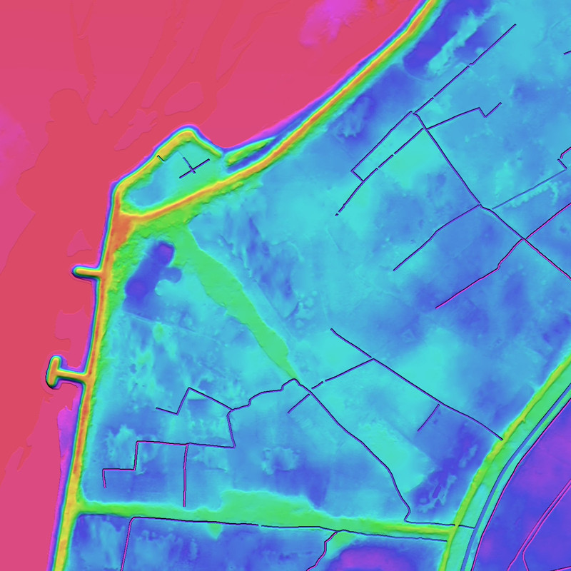
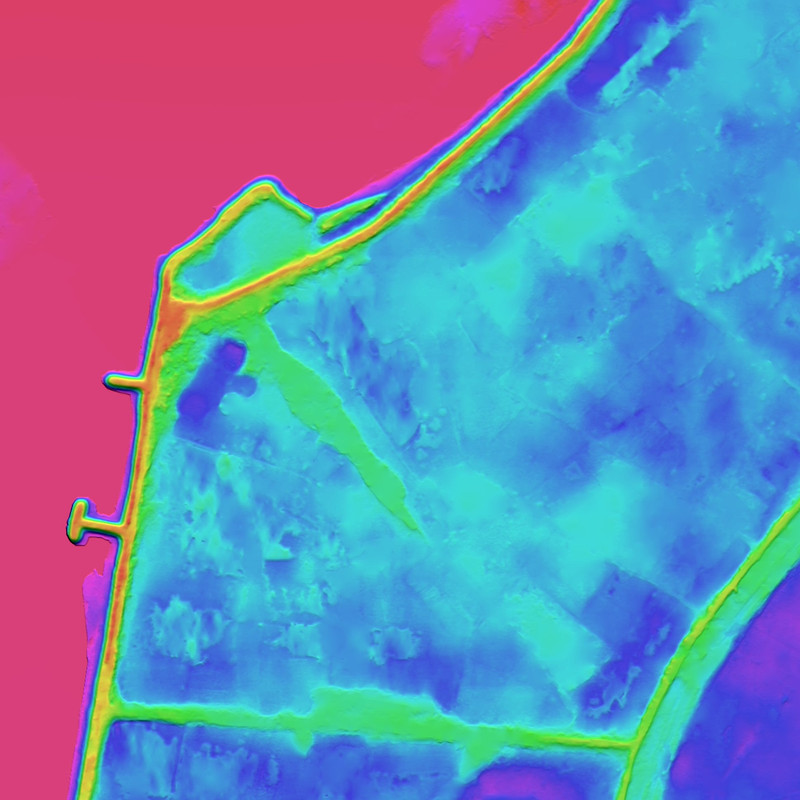
Digital Elevation Models (DEMs) come in several forms. DTM, DSM, and HDTM are three different elevation model types used for different outcomes. A DTM (Digital Terrain Model) represents bare-earth ground (no buildings/trees). A DSM (Digital Surface Model) represents the top surface of the landscape including buildings and vegetation. An HDTM (Hydro-Enforced Digital Terrain Model) is a hydrologically corrected DTM that enforces realistic water flow paths for flood, drainage, and watershed modeling. Selecting the wrong model can directly affect telecom RF simulations, flood-risk outputs, and urban planning accuracy.
Quick Facts
- DTM (bare earth): ground only; best for terrain-driven analysis (e.g., base topography, slope, cut/fill).
- DSM (surface + objects): includes buildings/trees; best for line-of-sight, obstacle-aware modeling, and 3D context.
- HDTM (hydro-corrected terrain): DTM enhanced to remove flow-blocking artifacts (e.g., bridges/embankments) and ensure drainage continuity.
What is a DTM (Digital Terrain Model)?
A Digital Terrain Model (DTM) is an elevation model that represents the bare-earth surface, the ground surface with vegetation, buildings, and man-made structures removed. DTMs are commonly produced by starting from a surface model and applying object-removal algorithms (often combined with quality control and manual edits) to isolate terrain.
LuxCarta DTMs can be generated using tri-stereo satellite imagery, supporting high-resolution elevation products designed for consistent, scalable production via AI-driven workflows.
When should you use a DTM?
Use a DTM when your analysis needs terrain only, without above-ground obstructions.
Common DTM use cases:
- RF & 5G planning (terrain baseline): modeling signal propagation without interference from obstacles.
- Flood screening (terrain-only context): initial flow direction and terrain slope analysis (note: use HDTM for hydrologically enforced modeling).
- Mobility and accessibility studies: slope and grade assessment for vehicles or pedestrians.
- Engineering and environmental planning: grading, corridor planning, and site suitability where terrain is the primary variable.
👉 Learn more about LuxCarta’s DTM here


What is a Digital Surface Model (DSM) ?
A Digital Surface Model (DSM) is an elevation model that represents the Earth’s surface as observed from above, including terrain plus above-ground features such as buildings, vegetation, and infrastructure. DSMs are often used when obstacles and heights matter for analysis, simulation, and visualization.
LuxCarta DSMs can be produced from tri-stereo satellite imagery, which helps reduce occlusions (blind spots) and improve completeness. In many DSM production workflows, water surfaces (e.g., lakes and wide rivers) may be flattened for consistency, and datasets are commonly delivered in interoperable GIS formats such as GeoTIFF.
When should you use a DSM?
Use a DSM when you need real-world surface heights, including buildings and trees.
Common DSM use cases:
- Telecom RF planning: obstacle-aware propagation studies, line-of-sight analysis, and coverage planning in built-up areas.
- Urban planning & smart cities: 3D surface context for development scenarios and zoning studies.
- Simulation, training, and defense visualization: realistic terrain + object surfaces for synthetic environments and virtual training.
- Energy and utilities planning: siting constraints influenced by surface features (e.g., vegetation, built structures).
👉 Learn more about LuxCarta’s DSM here


What is an Hydro-Enforced Digital Terrain Model (HDTM)?
An HDTM (Hydro-Enforced Digital Terrain Model) is a terrain model designed specifically for hydrologic and hydraulic correctness. While a standard DTM represents bare earth, it can still contain terrain artifacts that disrupt natural drainage, such as bridges, road embankments, or elevation discontinuities that incorrectly block water movement.
An HDTM corrects and enforces flow paths so that rivers, streams, channels, and drainage networks behave realistically in water-related models. This makes HDTM the preferred elevation base for flood modeling, watershed analysis, and climate-resilience planning.
When should you use an HDTM?
Use an HDTM when water behavior must be accurate, especially for flood extent, runoff, and drainage connectivity.
Common HDTM use cases:
- Flood risk assessment: hydrologically consistent elevation inputs for floodplain and inundation modeling.
- Watershed and drainage modeling: runoff routing, catchment delineation, and stream network coherence.
- Infrastructure and land development: verifying that roads, culverts, and new construction won’t create unintended flooding.
- Climate resilience and insurance analytics: improved hazard modeling for governments, municipalities, and risk teams.
👉 Learn more about LuxCarta’s HDTM here
How do you choose the right elevation model?
Choose based on what must be “true” in your analysis: ground, surface obstacles, or water flow realism.
1) Choose DTM if you need bare-earth terrain
Pick a DTM when you want the ground surface without buildings and vegetation for terrain-driven modeling.
2) Choose DSM if obstacles and heights affect outcomes
Pick a DSM when trees, buildings, and infrastructure must be represented (e.g., line-of-sight, obstruction impacts).
3) Choose HDTM if water modeling accuracy is required
Pick an HDTM when bridges, embankments, and drainage connectivity can change results—especially in flood and watershed studies.
Practical rule of thumb:
- If your question is “What is the ground elevation?” → DTM- If your question is “What blocks the view or signal?” → DSM
- If your question is “Where will water actually flow?” → HDTM
Why model choice matters (telecom, flood risk, urban planning)
Using the wrong elevation model can change results in ways that are hard to detect later:
- Telecom / 5G RF planning: A DSM is typically required for obstacle-aware analysis; a terrain-only model may underrepresent clutter effects in dense urban areas.- Flood risk and drainage: A non-hydro-enforced terrain can create false dams or incorrect flow barriers, skewing inundation outputs.
- Urban simulation & digital twins: DSM-like surfaces support realistic built-environment context; DTMs support ground-truth terrain under the city fabric.
LuxCarta’s differentiator is AI-driven automation for on-demand, scalable production of consistent geospatial datasets, including high-resolution elevation models that support RF planning simulations, digital twins, and water-aware terrain analysis across global projects.
Key Takeaways
- DTM = bare-earth terrain- DSM = surface including buildings and vegetation
- HDTM = hydrologically corrected DTM
FAQs
Conclusion
DTM, DSM, and HDTM each provide unique insights into the Earth’s surface. While they may sound similar, their differences are crucial depending on your application, from telecom planning to flood risk assessment.
At LuxCarta, we provide globally consistent, high-accuracy elevation datasets that help planners, engineers, and analysts make informed decisions with confidence.
👉 Talk to our experts today to find out which model best suits your project or explore our elevation models for more technical details.
About LuxCarta
LuxCarta develops high-resolution 2D and 3D geospatial products, including digital twins, elevation models, building footprints, and AI-enhanced geodata via the BrightEarth platform.
With 30+ years of experience supporting wireless operators and defense planning, LuxCarta enables on-demand, scalable digital map production for telecom RF planning, simulation and training, smart cities, government, and technology teams worldwide.