Focused on Telecom Geodata
At LuxCarta we focus on the development and delivery of geospatial products used in RF planning simulation software such as Forsk’s Atoll, InfoVista’s Planet and Teoco’s Asset.
Global Scale
In addition to three decades of experience serving the needs of users across a broad range of industries, our global operations and sales infrastructure is geared to serve over 500 customers.
Geodata Production Enhanced by AI
Including automated building footprint extraction and other algorithmic approaches to digital map creation. Sizeable R&D investment in computer vision and AI to build toolsets that automate our production pipelines.
-

Wireless
-

Simulation & Training
-

Smart Cities
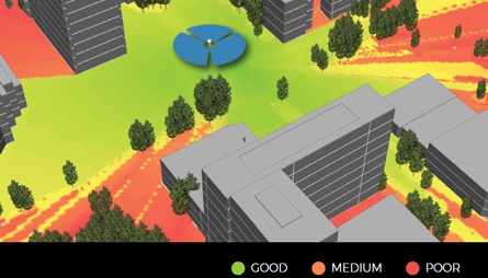
Wireless Industry
We have specialized in creating digital geodata for the wireless telecommunications industry since our inception. In that time, we’ve witnessed and supported our wireless operators as they deployed 2G, 3G, 4G and now 5G NR networks.
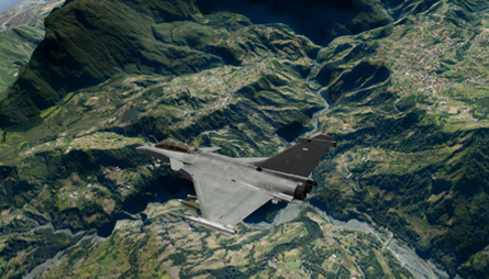
Simulation & Training
LuxCarta has a long history in the creation and delivery of digital 3D geodata and worldwide land use/land cover for simulations used by customers in a series of applications. This data is ideal for training use in land and air simulators, as well as related image generators.
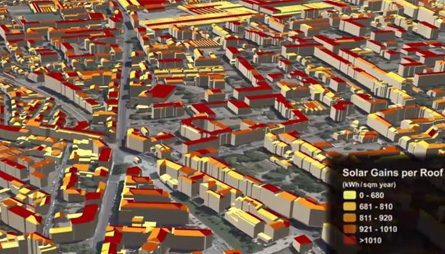
Smart Cities
LuxCarta’s Geospatial Products are designed for various industries including companies specialized in “Energy Transformation”, to compute solar roof maps (solar cadastre) and assess the photovoltaic potential by buildings roofs over specific urban areas.