Coverage & Geospatial Data
Singapore 3D City Model for Telecom Industry
Explore LuxCarta's precise 3D city model of Singapore for optimized 5G RF planning and telecom industry solutions.
Unlock 5G potential in San Diego with LuxCarta's detailed 3D city model, designed for telecom RF planning accuracy.
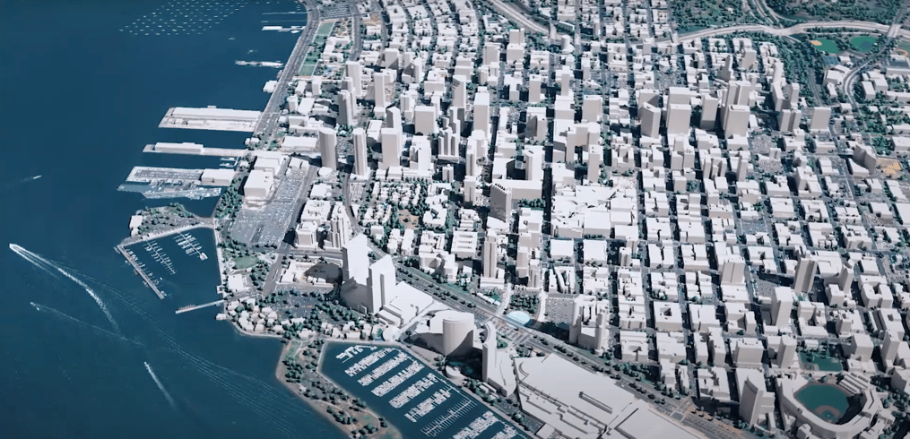
As the telecom industry gears up for the 5G revolution, the need for detailed and precise planning tools has never been greater. LuxCarta is excited to introduce its San Diego 3D City Model, meticulously crafted to support the telecom sector in RF planning and network optimization for 5G deployment.
LuxCarta's San Diego 3D city model epitomizes our dedication to delivering geospatial accuracy. Created using state-of-the-art satellite imagery and cutting-edge 3D reconstruction technologies, our model captures San Diego's diverse urban and natural landscapes with unparalleled detail. It provides a comprehensive base for simulating 5G signal propagation and optimizing network infrastructure placement.
The complex urban terrain of San Diego, with its varied elevation and dense infrastructure, poses unique challenges for 5G network planning. LuxCarta’s 3D city model is specifically designed to address these challenges, offering a high-resolution depiction of the city that enables precise signal behavior analysis. This is essential for the effective placement of 5G antennas and ensuring superior network coverage and capacity.
LuxCarta specializes in geospatial solutions, with a keen focus on the evolving needs of the telecom industry. Our San Diego 3D city model is not just a tool, but a strategic asset designed to facilitate the transition to 5G technology, ensuring that telecom providers can deliver the best possible service to their customers.
Elevate your RF planning and network design capabilities with LuxCarta's San Diego 3D city model. Reach out to us to learn how our geospatial expertise can empower your 5G deployment strategies in San Diego.

Explore LuxCarta's precise 3D city model of Singapore for optimized 5G RF planning and telecom industry solutions.
Elevate 5G planning in Marrakech with Luxcarta's detailed 3D city model, blending historical charm with urban innovation for peak network performance
Optimize 5G planning in Auckland with LuxCarta's detailed 3D city model, blending natural beauty with urban innovation for peak network performance