Listen to audio version of this blog post:
If you use digital maps, it’s important to understand key terms and concepts. In this blog, we explore the differences between digital elevation models (DEM), digital terrain models (DTM), and digital surface models (DSM).Key takeaways:
- Geographic information system (GIS) maps can represent the surface of the earth in many different ways
- Anyone using 3D mapping technology needs to understand the difference between major concepts
- We compare DEM vs DTM vs DSM
- Learn the differences between each kind of model and what they’re used for
More and more organizations, in an ever-growing range of industries, are using geospatial data analysis today - according to analysis from Deloitte. By generating and analyzing detailed maps, you can gain valuable new insights into the places you operate in, and improve how your business delivers its services.
In this article, we’ll compare three related but distinct acronyms around elevation data that you will invariably encounter when working with GIS: digital elevation models (DEM), digital terrain models (DTM), and digital surface models (DSM). Although they share a lot in common, these three terms have specific meanings, and it’s vital to know how they differ.
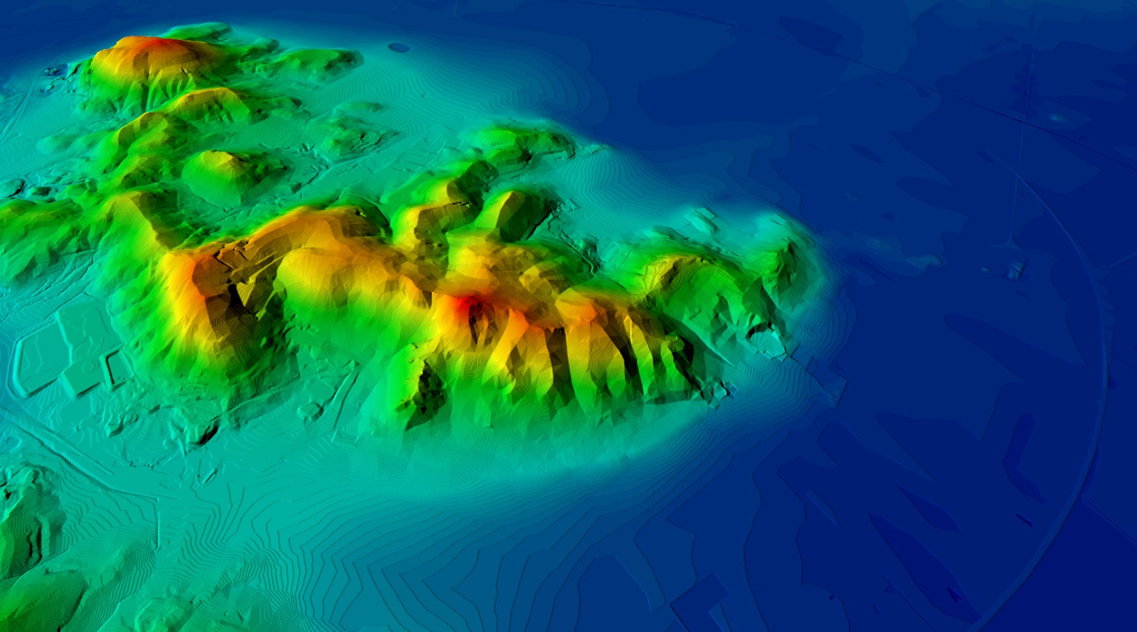
DTM digital terrain model Oruro, Bolivia
DEM vs DTM vs DSM
GIS software can show layers of geographical information in vector or raster format. Each layer provides different kinds of information. Terrain is one of the most widely used and can be divided into digital elevation, terrain, and surface models. Let’s learn what they are and how they differ.
What is a DEM?
A digital elevation model (DEM) is a general term representing ground elevation above sea level. In a DEM, all surface features (trees, buildings, bridges, etc.) are stripped away, and only the ‘bare earth’ is represented.
A DEM will show you:
- Topographic mapping information (hills, valleys, etc.)
- Slopes
- River beds
- Furrows and ridges (which may be man-made or natural)
Elevation is usually represented by color. For example, elevations of 0-10 m above sea level might be blue, 11-20 m above sea level could be orange, 21-30 m above sea level could be red.
What is a DTM?
Depending on where you live, a digital terrain model (DTM) may be identical to a digital elevation model. However, businesses or GIS software may represent something slightly different in some countries.
If your organization differentiates between DEM and DTM, then the DTM will be a layer ‘on top’ of the DEM. It will show additional information that the ‘bare earth’ DEM might not represent, including things like:
- Breaklines are changes in the terrain on a surface (such as landslides) that may not be elevated above the surface but contain important information.
- Manmade and natural linear features of the bare earth terrain, such as roads, railway tracks, flood defences, pipelines, coastlines, or rivers, may not be elevated above the bare earth. Still, they will be identified on the model.
What is a DSM?
A digital surface model (DSM) is a type of terrain that includes all features above the bare earth - both natural and man-made. It will include ground features such as buildings, infrastructure, trees, and vegetation. The layer will represent the height of all these features above the ground on which they stand.
Dig deeper: Our in-depth guide to digital surface models
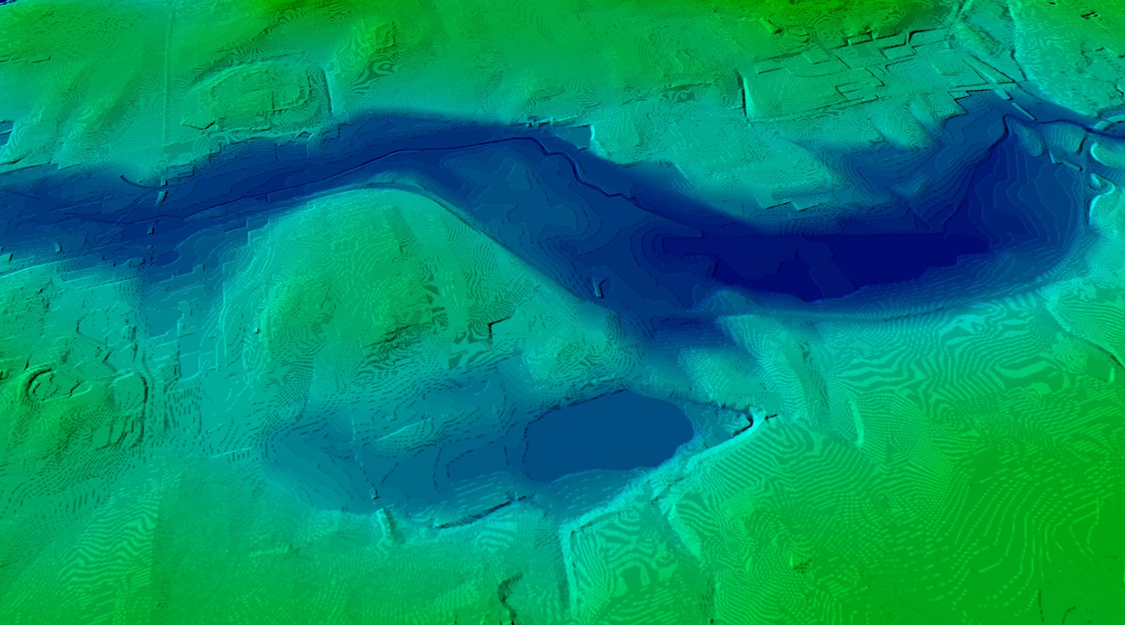
DTM digital terrain model Vancouver
The importance of shared language when talking about elevation data
Despite meaning different things, the acronyms DEM, DTM, and DSM are often used interchangeably (particularly DEM and DTM). Unfortunately, there is no universal definition of these terms, and they can be used in different ways in different contexts.
This is confusing and can cause problems with communication, especially when people from different organizations are working together.
For example, imagine two companies are collaborating on a flood management project. Maria works for Company A, and understands DEM and DTM as synonyms for ‘bare earth’. However, she’s collaborating with Hans from Company B. For Hans, DTM means bare earth plus linear features such as roads.
These different interpretations could significantly impact how each company approaches the project. Hans would be looking at a map that shows important features such as roads, whereas Maria might ‘miss’ this key information. That would have a significant impact on how each company plans its part of the flood management project.
To avoid this kind of problem, it’s useful to:
- Clearly define all acronyms at the start of any project
- Keep a list of acronyms in a shared folder that everyone involved can access
- Foster an open culture where people feel comfortable raising questions
How they’re made: Understand how LiDAR is used to create DEM and DSM models
DEM vs DTM vs DSM: major uses
Geographic Information Systems with DEM, DTM, and DSM layers are used in many industries for various reasons.
Very often, professionals will use multiple kinds of models at different stages of a project. For example, an architect might use a digital elevation model to understand the angle of a slope when planning the foundations of a building. They’ll then use a digital surface model to understand the lines of sight from their structure. The DSM could, for instance, help them see whether trees may block sunlight - this information wouldn’t be available in the DEM.
Here are some major uses of DEM, DTM, and DSM.
Major uses of digital elevation models (DEM) and digital terrain models (DTM)
Digital elevation models and digital terrain models help you understand the ‘natural’ shape of the earth’s surface - without the ‘distraction’ of buildings, trees, or other infrastructure. DEMs and DTMs are especially useful for things like:
- Hydrology: Understand the flow and accumulation of water across a landscape.
- Terrain form: Consider the earth's ‘natural’ shape when planning buildings, tunnels, pipelines, roads, wind farms, and other infrastructure.
- Stability: Estimate the stability of slopes, especially for mass movements (such as avalanches).
- Simulations: When creating airplane pilot training simulations, know the elevation data for real-world mountains, hills, or valleys.
- Emergency planning and analysis: Learn how floods, earthquakes, and landslides will affect and disrupt the landscape.
Major uses of digital surface models (DSM)
Digital surface models show you both ground elevation and the height of everything above it. This allows you to understand how ground features interact with one another and the bare earth. DSM’s are useful for things like:
- Radio frequency planning: Understand the terrain's impact with radio signals in RF planning.
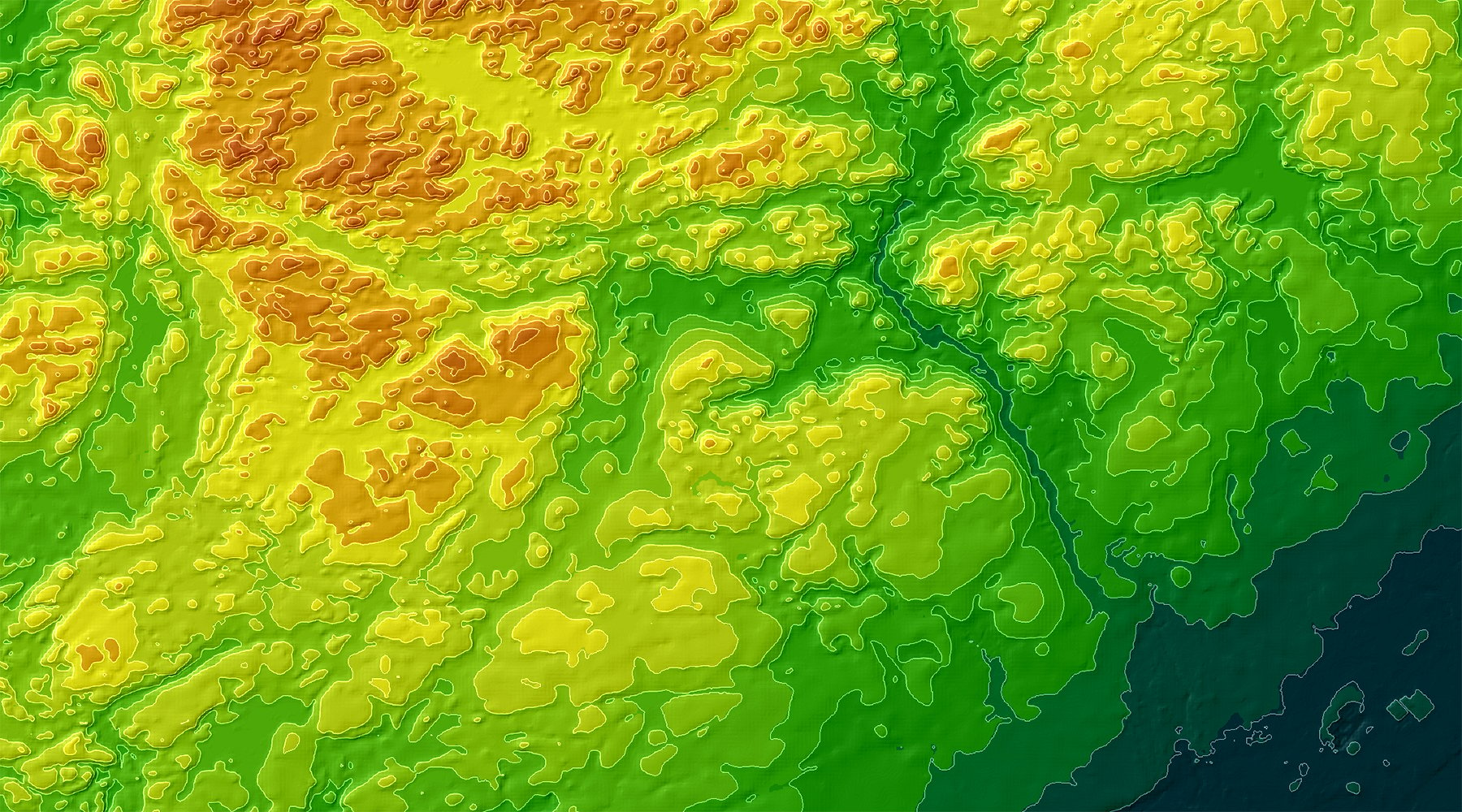
 Prague - Czech Republic terrain model
- Private networks: Watch the application of high-resolution satellite mapping for a private wireless network in Brazil, with the example of a mine:
- Simulations: Create realistic, high-resolution simulations of places in the real world for various purposes (such as military training).
- Line of sight planning: For architecture or engineering, understand what features will be visible from a building, and how the building would appear from different positions.
- Digital twins: Use digital surface models to create ‘digital twins’ of real-world places (e.g. entire cities, neighborhoods, ports etc.) and explore how changes would affect them.
- Emergency planning and analysis: Particularly useful in urban areas, DSMs can help with planning emergency responses in the case of terrorist attacks, fires, floods, or earthquakes.
- Smart city mapping: Understand building position, elevation, and angle to plan for IoT, solar panel location, and other smart city applications.
DEM, DTM, and DSM maps for all
Modern mapping technology is increasingly accessible, and organizations in a wide range of industries are now using DEM, DTM, and DSM models for all manner of purposes.
LuxCarta, a leading remote sensing company, has extensive expertise in extracting valuable information from the Earth's surface, including generating detailed Digital Elevation Models (DEMs), Digital Terrain Models (DTMs), and Digital Surface Models (DSMs) at various resolutions and accuracy levels. Whether you need high-resolution elevation data for flood risk analysis, detailed vegetation maps for 5G network planning, or accurate DSMs for creating realistic simulations, LuxCarta's team of experts can provide the data and services you need.
Contact LuxCarta today to learn how their advanced remote sensing solutions can support your specific requirements.
