Controlled by clicks.
Outputs geometry.
An AI assistant controlled by fast clicks, it edits vector layers directly in QGIS .
Three tools, one workflow
Each tool is one click inside your QGIS session.
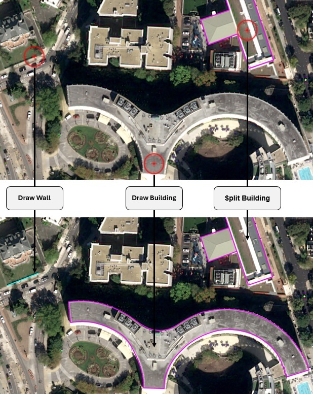
Draw building
One click on a rooftop returns a closed, regularized building footprint. Curved and irregular structures are traced as they are, without being forced into a rectangle.
Draw wall
One click along a wall or fence returns an open linestring. Linear features are predicted natively, not derived from a filled area.
Split building
One approximate click near the boundary of a merged block returns the dividing edge, splitting it into individual units with the boundary intact.
Beyond mask-based extraction
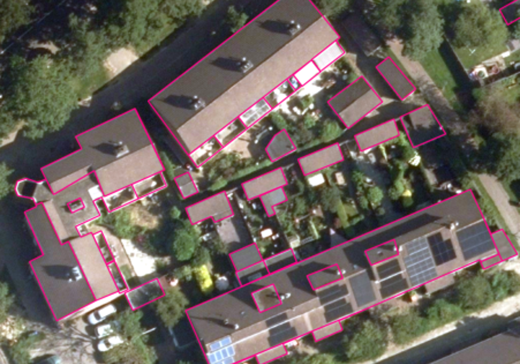
Most AI-assisted mapping tools produce a raster mask, then convert it to a polygon. That second step is where precision is lost: narrow passageways get closed, shared boundaries drift, and open features like walls cannot be represented at all.
Click2Poly is a vision-language model that predicts vector geometry directly. There is no mask and no conversion step, so topology holds and linear features come out as linestrings rather than thin polygons.
The result is geometry an operator accepts rather than repairs.
Built for production
Click2Poly was tested under controlled conditions across four production areas, with four operators working the same imagery. Total manual correction time fell by roughly a third, an overall speedup of about 2.6x.
It is robust across resolutions, from 30 cm satellite imagery to high-resolution aerial data, without retraining. Prediction is near-instant on a standard workstation GPU, so the tool keeps pace with the operator instead of interrupting them.
It ships as a QGIS plugin, ready to drop into an existing production line. Production-grade, not prototype-grade, the same standard behind every dataset we deliver.
What is Click2Poly?
Click2Poly is a QGIS plugin developed by LuxCarta that turns a single operator click into finished vector geometry. It predicts building footprints, wall linestrings and boundary splits directly, without producing an intermediate raster mask that then has to be converted.
What do I need to run Click2Poly?
Click2Poly runs as a plugin inside an existing QGIS installation, so it fits into a production line without changing it. Prediction runs on a standard workstation GPU and returns geometry fast enough to keep pace with an operator working continuously.
How much time does Click2Poly actually save?
In controlled testing across four production areas with four operators, total manual correction time fell by roughly a third, an overall speedup of about 2.6x. Gains are largest in dense residential and commercial areas, where merged blocks and linear features create the most cleanup work.
What imagery does Click2Poly work with?
Click2Poly works on optical satellite imagery from around 30 cm per pixel, and holds up on higher-resolution aerial imagery without retraining. It handles irregular and curved structures as they are, rather than forcing every footprint into a rectangle.
Talk to the team behind it
Click2Poly is presented at IGARSS 2026 in Washington D.C. on Tuesday 11 August. If you want to see it on your own imagery, get in touch.