Elevation Data for Risk Modeling, Disaster Planning & Resilient Infrastructure
Accurate risk modelling starts with accurate terrain data. Insurers, reinsurers, governments, and infrastructure planners rely on high-resolution elevation models to simulate flooding, storm surge, dam failure, and runoff scenarios with confidence.
LuxCarta provides hydro-enforced Digital Surface Models (DSM), Digital Terrain Models (DTM), and Hydro-Enforced DTMs (HDTM) that support predictive modelling, exposure analysis, and resilience planning. By aligning terrain data with real-world water flow behavior, risk models become more reliable, defensible, and actionable.
Why elevation data matters in risk modelling
Flood, coastal, and infrastructure risk models are highly sensitive to terrain accuracy. Small elevation errors can significantly distort:
● Flood extent boundaries
● Water depth estimations
● Exposure calculations
● Insurance loss projections
Hydrologically corrected terrain ensures that water flows realistically through river networks, urban drainage systems, and coastal environments, reducing simulation errors and improving confidence in decision-making.
Applications enabled by LuxCarta’s elevation data
LuxCarta’s hydro-enforced terrain supports a wide range of modelling workflows across insurance and public-sector use cases.
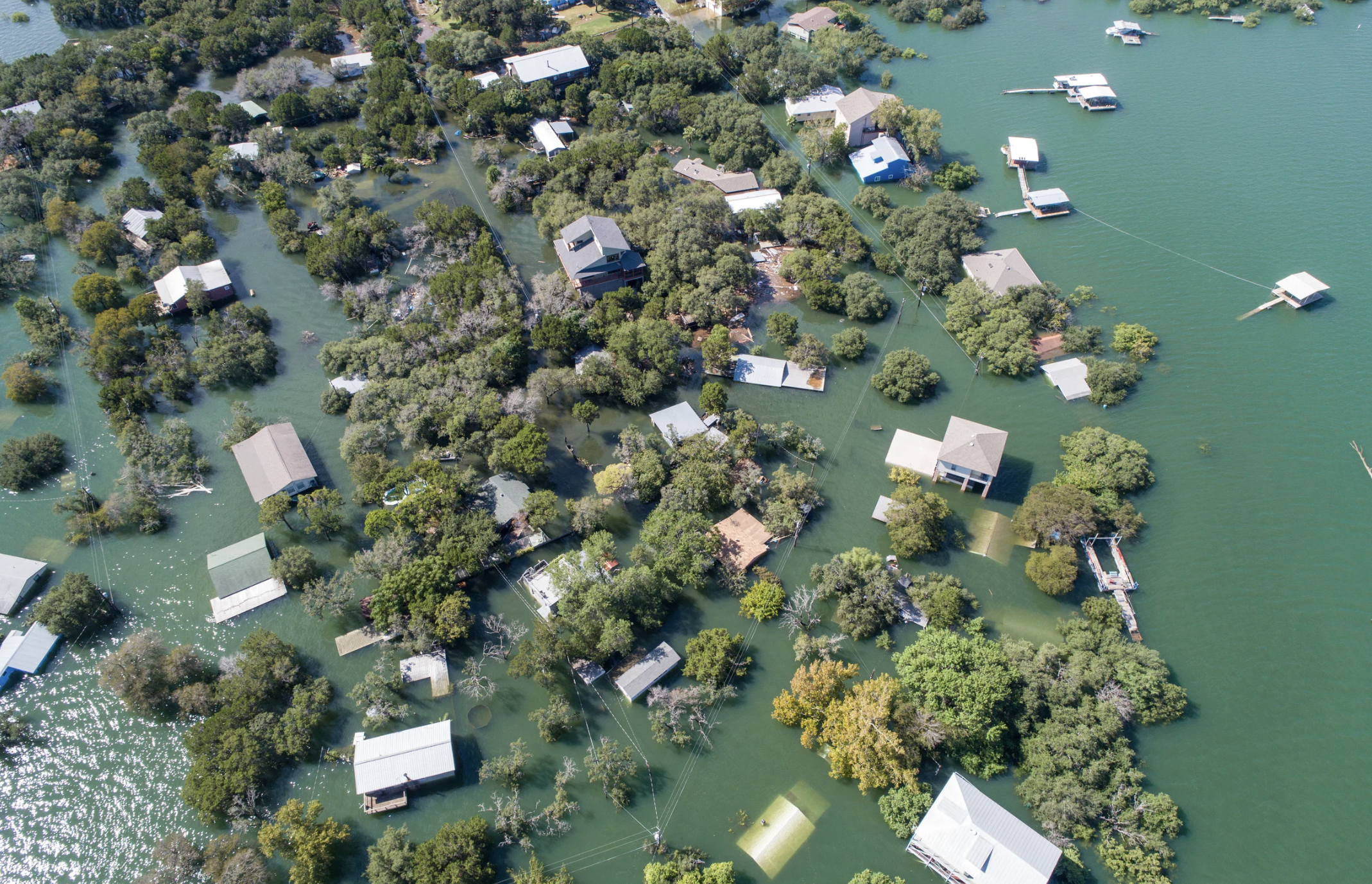
Flood Risk & Inundation Mapping
Model riverine, pluvial, or coastal flooding scenarios using terrain aligned with real-world hydrology. Improve floodplain delineation, exposure assessment, and insurance underwriting accuracy.
Urban Drainage & Stormwater Management
Simulate runoff behavior and drainage capacity to enhance infrastructure resilience and reduce insurance and municipal risk.
Dam Break & Reservoir Risk Assessments
Evaluate downstream impact zones from controlled releases or dam failure scenarios using topographically accurate terrain.
Emergency Response Planning
Identify safe zones, evacuation routes, and accessibility constraints based on slope, elevation, and flood-prone areas.
Infrastructure Risk & Resilience Design
Support planning of roads, transport networks, and utilities using clean bare-earth elevation data for accurate modelling.
Coastal Hydraulics & Erosion Modeling
Feed DSM and DTM datasets into coastal and estuarine models to simulate surge, erosion, and long-term sea-level rise impacts.
Disaster Risk Agencies & Emergency Services
Supporting preparedness, early warning systems, and recovery planning.
Insurance & Reinsurance Companies
Improving exposure modelling, premium pricing, and claims forecasting.
Municipalities & Urban Planners
Enabling zoning decisions, infrastructure design, and climate resilience planning.
What makes LuxCarta different for risk modeling ?
- Hydrologically Enforced Terrain (HDTM) for realistic water flow modeling
- 30 cm to 1 m Resolution Inputs for precise AOI modeling
- Consistent Global Coverage with scalable production
- Simulation-Ready Formats (GeoTIFF, SHP, CAD-ready)
- Manual QA and proprietary processing algorithms
- Flexible licensing by AOI, region, or project scope
Scaling from local studies to national risk programs
This consistency is critical for insurers and governments that require standardized inputs across multiple territories.
Summary
Reliable risk modelling depends on reliable terrain data. Hydro-enforced elevation models reduce simulation uncertainty, improve exposure analysis, and support defensible decision-making across flood, infrastructure, and coastal risk scenarios.
LuxCarta delivers AI-enhanced, modelling-ready elevation datasets designed to scale from local assessments to global risk portfolios.
Looking for accurate terrain data for insurance?
LuxCarta’s HDTM delivers hydrologically correct elevation models for flood risk assessment, underwriting, and claims. Contact us today.