SimpliCity - Automated 3D Building Models from LiDAR & Footprints
SimpliCity automatically processes massive datasets to produce lightweight, watertight, and semantically enriched 3D building models. From smart city planning to simulation and infrastructure projects, it simplifies workflows and reduces costs while ensuring consistent, high-quality outputs.
Scalable Urban Reconstruction with High Fidelity
SimpliCity automatically processes massive datasets to produce lightweight, watertight, and semantically enriched 3D building models. From smart city planning to simulation and infrastructure projects, it simplifies workflows and reduces costs while ensuring consistent, high-quality outputs.
Fully Automated & Scalable
SimpliCity is built to process massive datasets with no manual intervention. Capable of handling up to 17,300 buildings per day, it delivers consistent and high-quality 3D outputs at scale. This automation not only accelerates production but also lowers costs, making large urban reconstruction projects more efficient and reliable.
Clean & Regularized Outputs
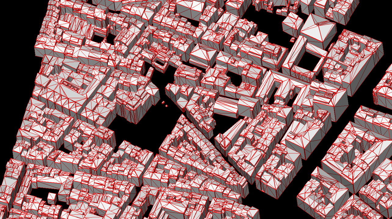
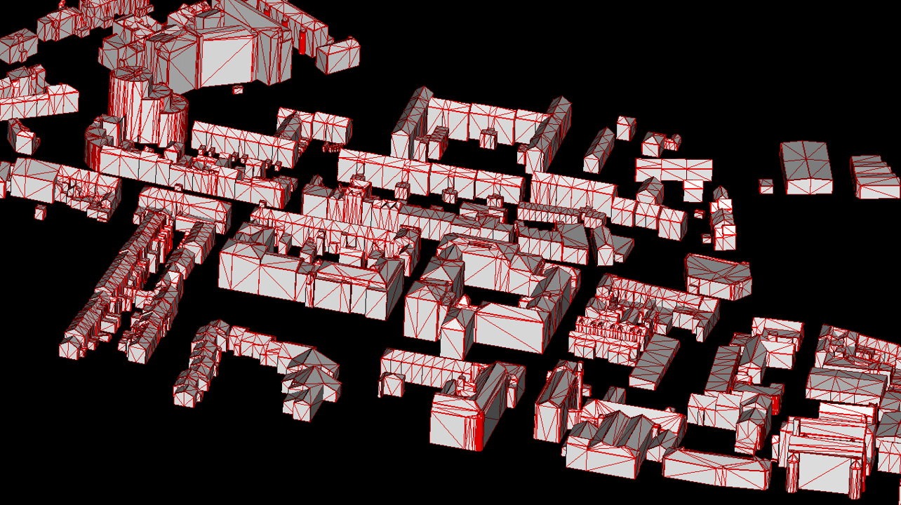
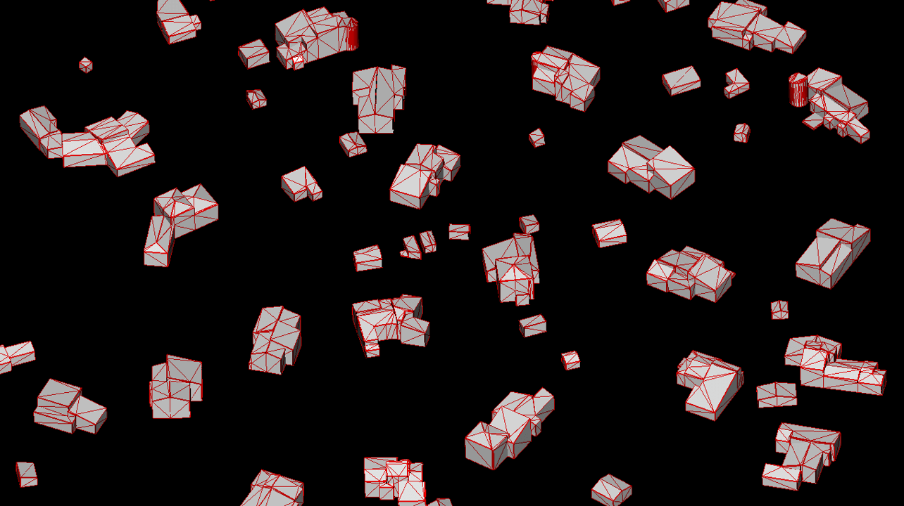
Every building model generated by SimpliCity is watertight, lightweight, and optimized for direct use in GIS, CAD, and 3D visualization platforms. By ensuring correct topology and adding semantic labels such as roof, wall, and ground, the solution delivers clean, standardized data that improves analysis, storage, and visualization workflows.
Flexible Deployment Options
SimpliCity adapts to your infrastructure needs with multiple deployment models. Whether accessed through SaaS for fast cloud availability, installed OnPremises for maximum security and sovereignty, or delivered directly via LuxCarta’s Production Services, it ensures predictable costs and compliance with your internal requirements while remaining easy to integrate.
What is LuxCarta SimpliCity?
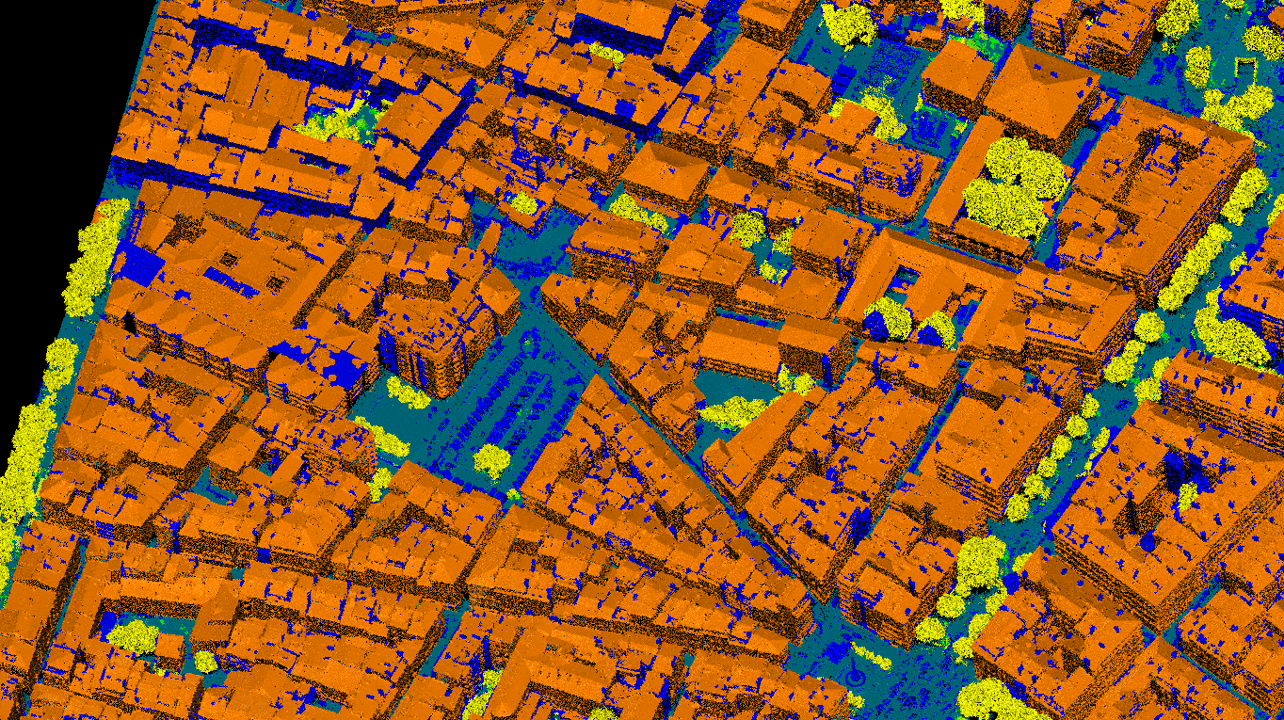
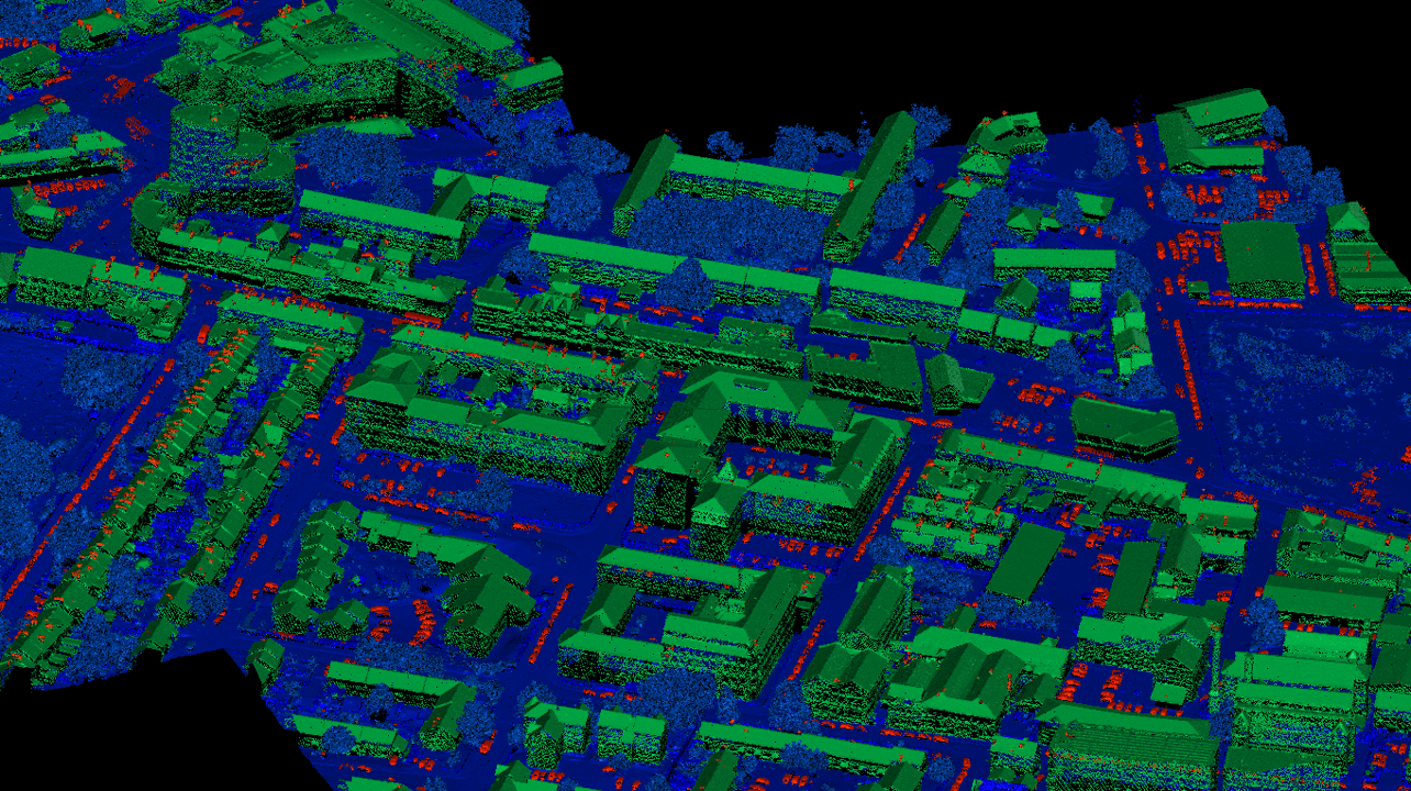
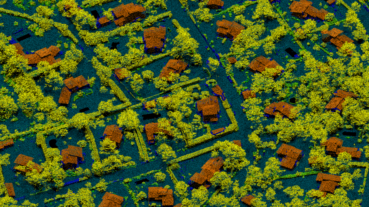
SimpliCity is an automated 3D building model generation software by LuxCarta. It processes LiDAR data and building footprints to produce clean, regularized, and watertight 3D urban models at scale, with no manual intervention required.
What input data does SimpliCity require?
SimpliCity works from LiDAR point cloud data and 2D building footprints. It can also integrate additional geospatial layers to enrich the output with semantic attributes
What 3D formats does SimpliCity output?
SimpliCity delivers models in standard GIS and CAD-compatible formats, ready for direct use in platforms such as ArcGIS, QGIS, Autodesk, CityGML, and simulation environments.
How is SimpliCity deployed?
SimpliCity is available as a cloud-based service or as an on-premise solution, adapting to the client's infrastructure and data security requirements.
Need reliable 3D building models?
LuxCarta’s SimpliCity automatically transforms classified LiDAR and building footprints into clean, regularized 3D models. Perfect for smart city planning, infrastructure monitoring, and simulation projects.
Contact us today.