AI-Powered Enhancement for Geospatial Intelligence
SuperRes automatically upgrades imagery resolution, enabling analysts, planners, and engineers to work with highly detailed data without increasing storage or processing complexity. From urban planning and infrastructure monitoring to environmental studies and simulation, SuperRes simplifies workflows and maximizes the value of satellite data.
AI-Powered Image Clarity
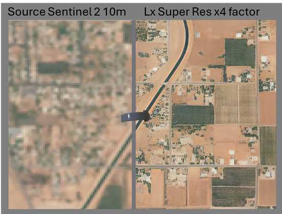
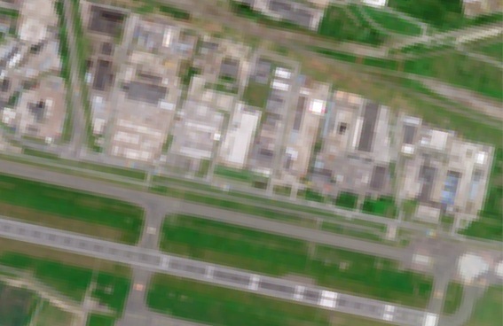
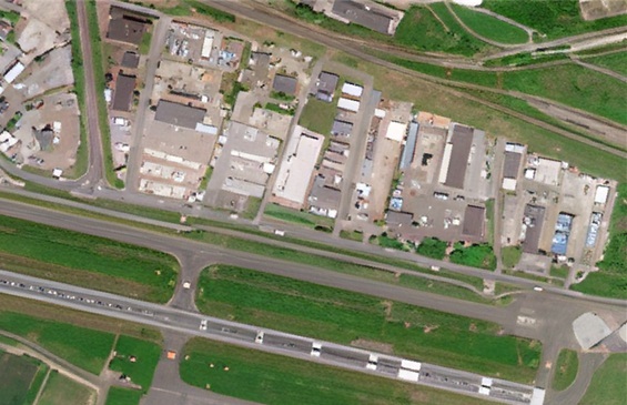
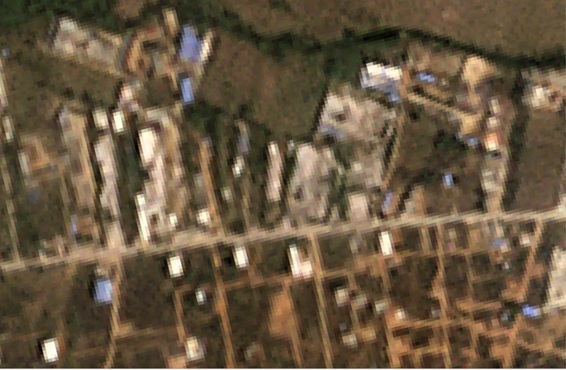
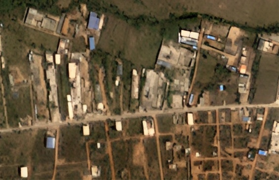
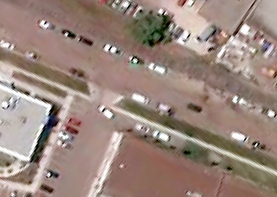
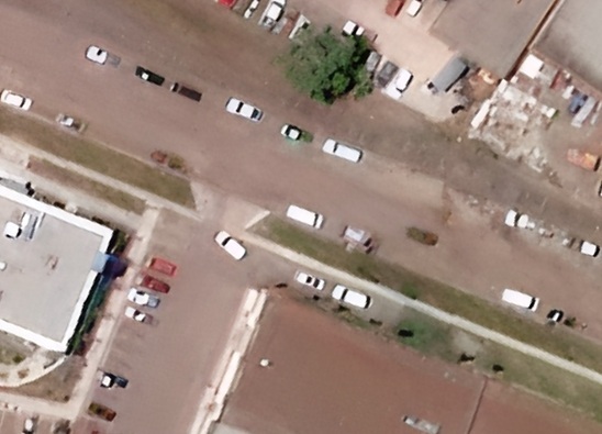
SuperRes leverages advanced AI to multiply image resolution by four, producing sharper, more detailed visuals. This allows users to better distinguish features such as urban structures, vegetation, or terrain patterns, enabling more accurate and confident decision-making in geospatial projects.
Scalable and Fast
Designed for high-volume processing, SuperRes can handle entire 100×100 km Sentinel-2 tiles in just minutes. This efficiency makes it possible to enhance massive datasets quickly, reducing costs and accelerating project timelines without compromising quality.
Easy Integration & Deployment
Outputs are standardized, lightweight, and directly compatible with GIS, CAD, and 3D visualization platforms. Whether accessed through SaaS for flexibility or deployed OnPremises for maximum control and security, SuperRes integrates seamlessly into existing workflows.
What is LuxCarta SuperRes?
LuxCarta SuperRes is an AI-powered super-resolution solution that enhances the spatial resolution of satellite imagery by up to 4×. It uses deep learning models specifically trained on geospatial data to deliver sharper, more detailed imagery for mapping, GIS, and 3D applications.
What resolution improvement does SuperRes provide?
SuperRes delivers up to a 4× resolution boost, for example, transforming 40 cm imagery into near-10 cm quality output, while maintaining geometric accuracy and radiometric consistency required for professional geospatial workflows.
What types of satellite imagery does SuperRes work with?
SuperRes is compatible with a wide range of optical satellite imagery, including imagery from providers such as Airbus, Maxar, and Planet. It supports standard geospatial formats and integrates with existing imagery pipelines.
How is SuperRes deployed?
SuperRes can be deployed on-premise or via cloud infrastructure, depending on your data sovereignty and processing requirements. LuxCarta provides API access and supports integration with GIS platforms, CAD tools, and 3D production workflows.
Need sharper satellite imagery?
LuxCarta’s SuperRes delivers 4× enhanced resolution for clearer, more detailed geospatial data. Perfect for urban planning, infrastructure monitoring, and environmental analysis.
Contact us today.