Surface, Terrain, and Water Flow Mapped with Precision
LuxCarta’s DxM product suite provides high-resolution elevation models designed for critical applications across urban planning, risk management, simulation, and environmental analysis. Whether you’re visualizing cities in 3D, modeling floodplains, or assessing climate risk, our DSM, DTM, and HDTM datasets offer scalable, accurate, and production-ready geospatial intelligence. Built from tri-stereo satellite imagery and refined through advanced algorithms and human quality control, DxM models are trusted by engineers, planners, hydrologists, and simulation experts worldwide.
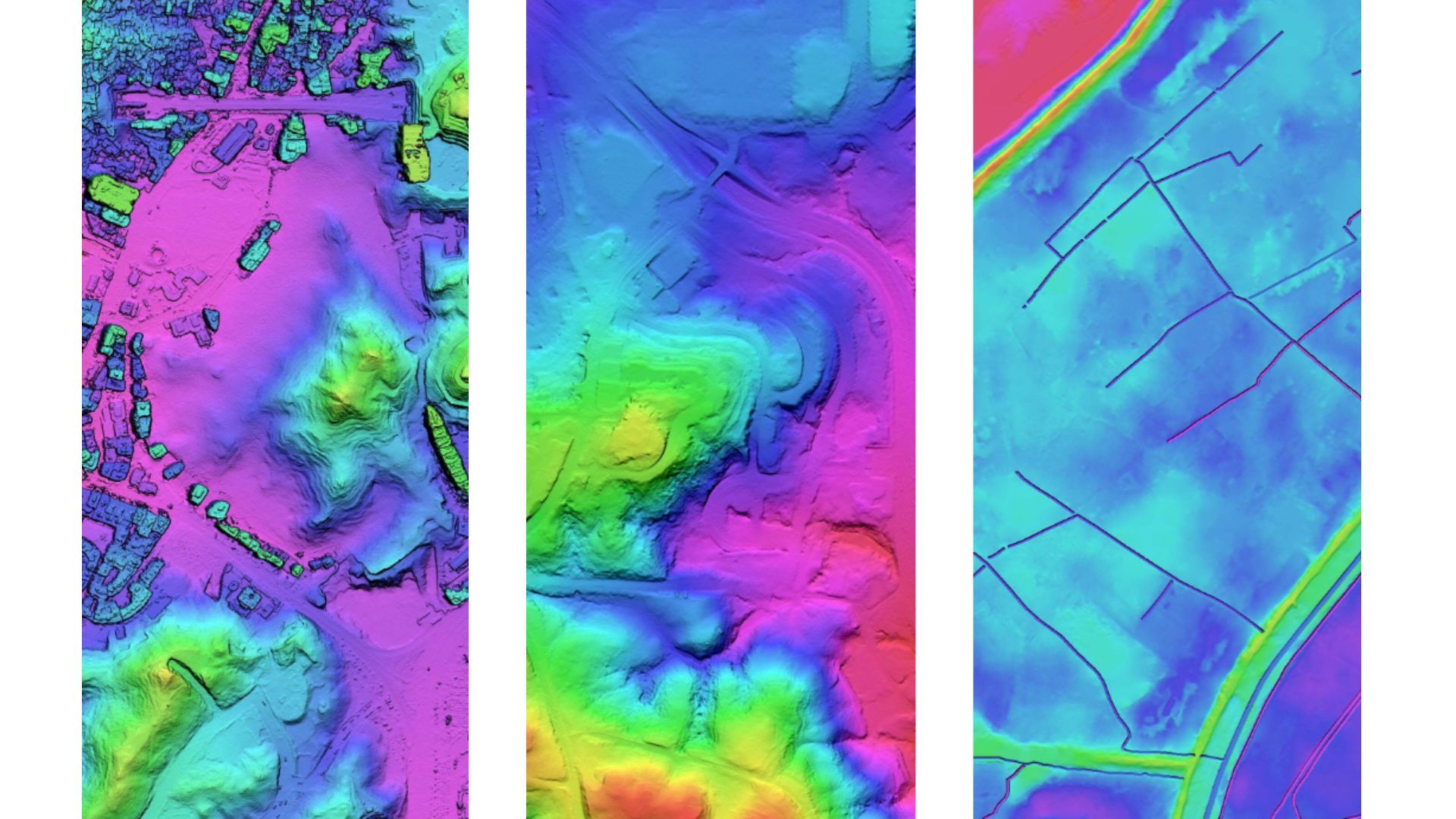
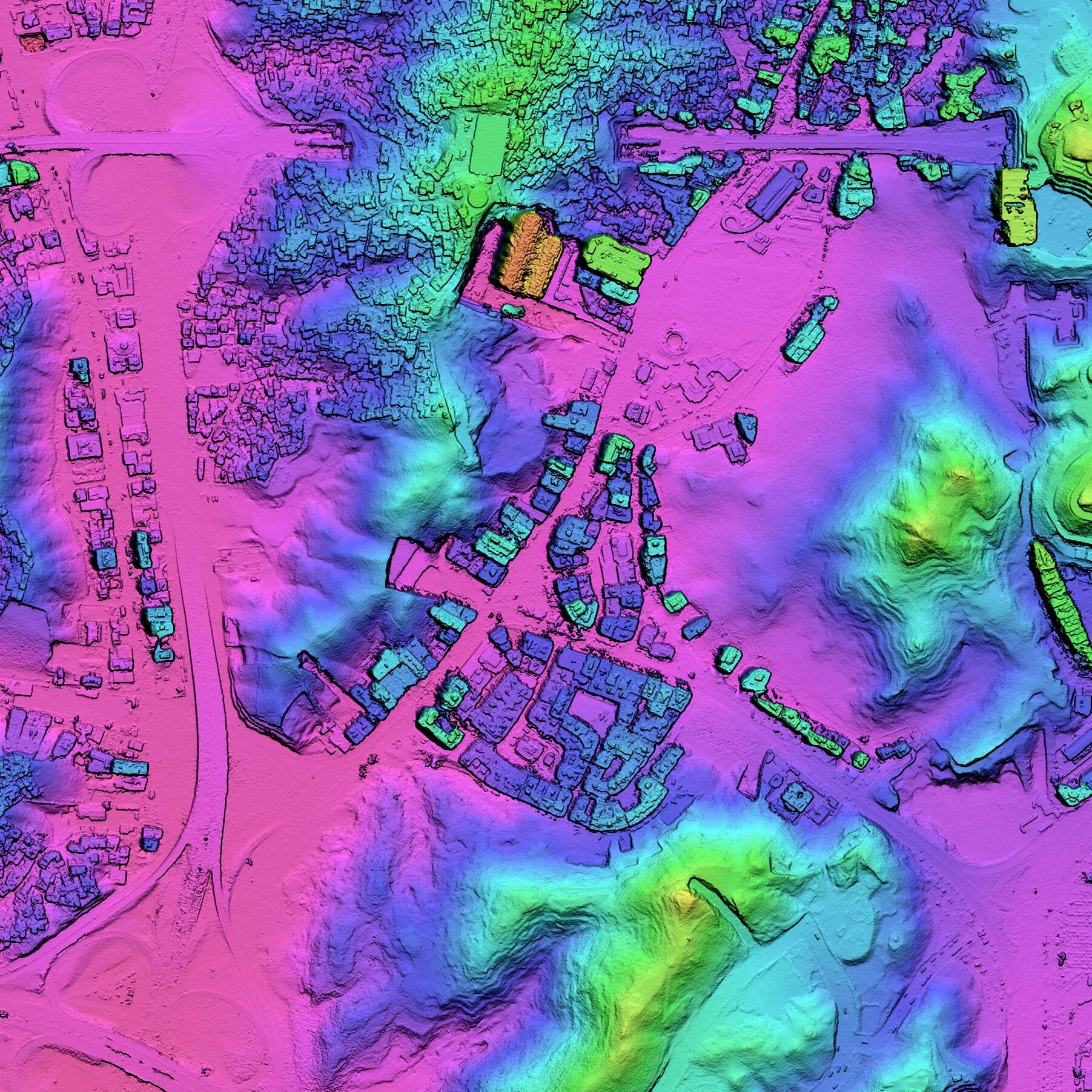
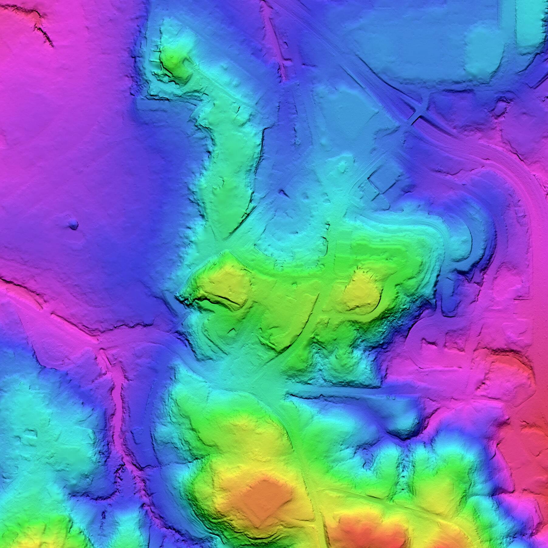
Digital Surface Model (DSM)
Digital Surface Model (DSM) representing the Earth’s surface including all above-ground features such as buildings, trees, and infrastructure. Essential for RF planning, urban studies, and line-of-sight analysis.
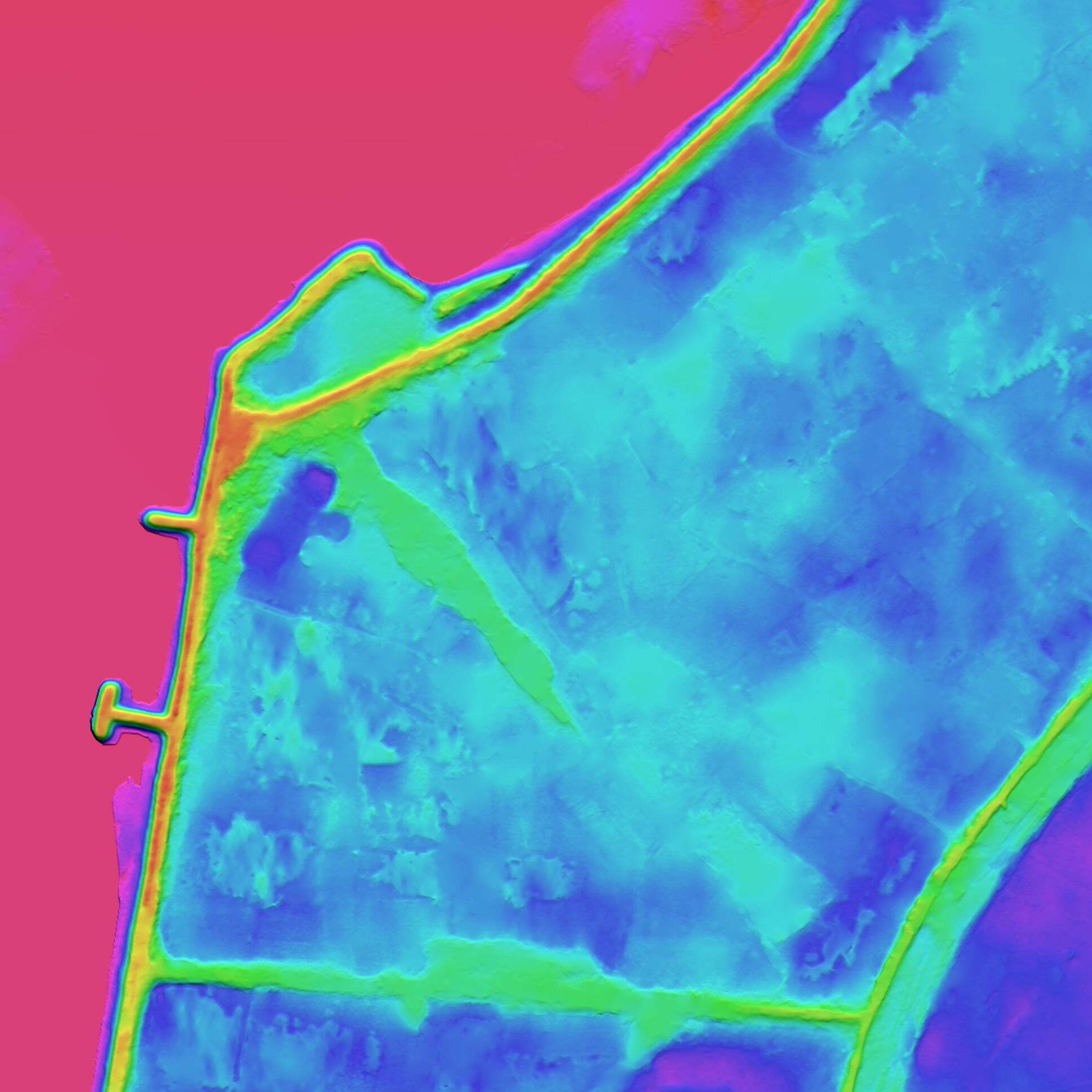
Digital Terrain Model (DTM)
Bald Earth Digital Terrain Model (DTM) representing the ground surface only, with optional transportation features (bridges, overpasses, elevated highways)
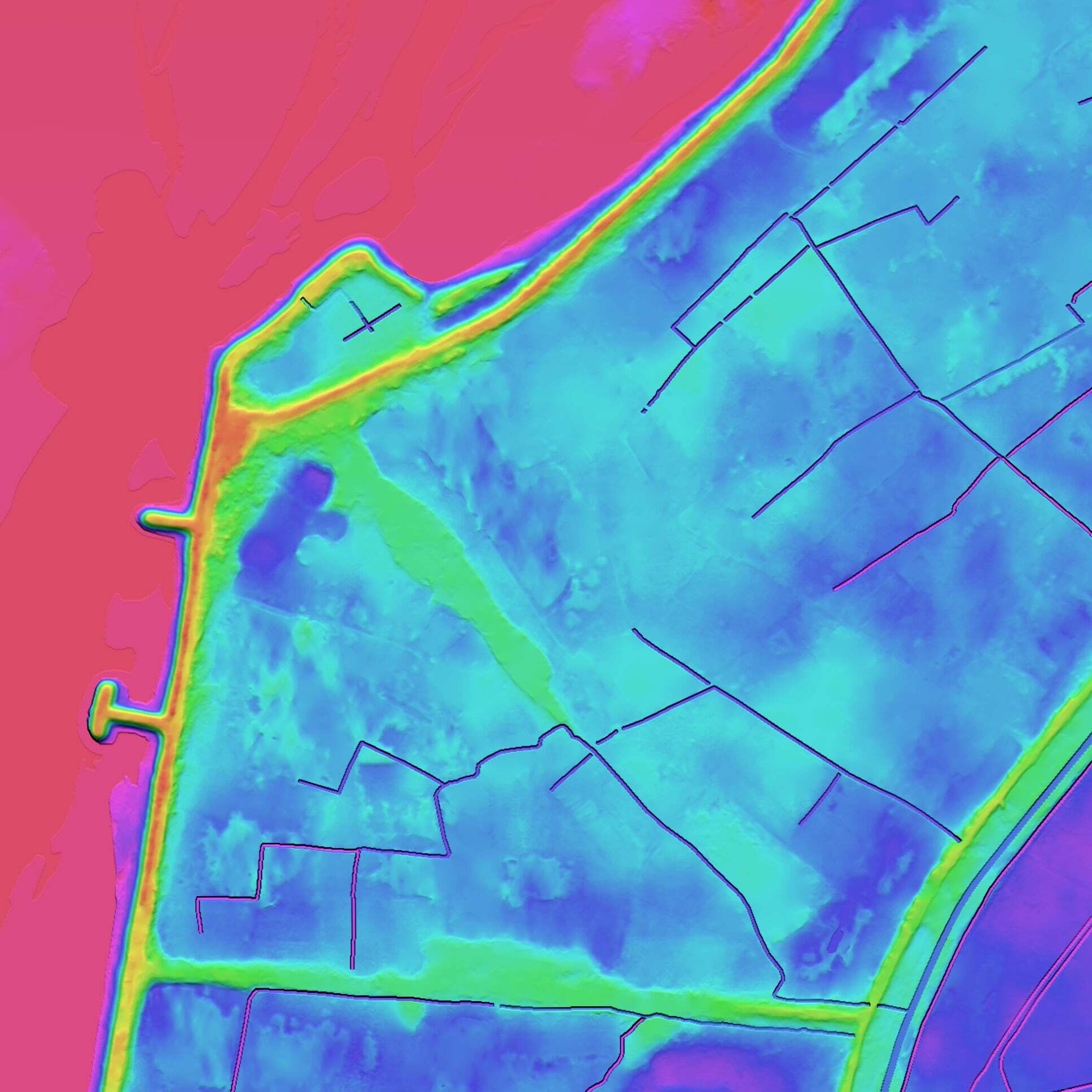
Hydro-Enforced Digital Terrain Model (HDTM)
Hydro-Enforced Digital Terrain Model (HDTM) providing a bare-earth terrain representation with integrated hydrological features such as rivers, lakes, and drainage networks. Designed to support accurate flood modeling, watershed analysis, and environmental studies.
Need reliable elevation data?
LuxCarta’s DXM suite (DTM, DSM & HDTM) provides accurate terrain and surface models for planning and analysis. Contact us today.