


Custom Precision
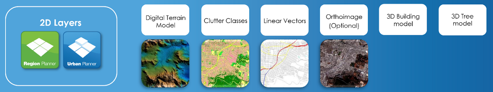
Designed for telecommunications planning and optimization. Offering custom mapping solutions, this platform allows you to tailor every detail—from land use classifications to vector data adjustments—to meet the specific requirements of your network projects. Optimize your urban telecom infrastructure with precision, ensuring maximum coverage and efficiency.

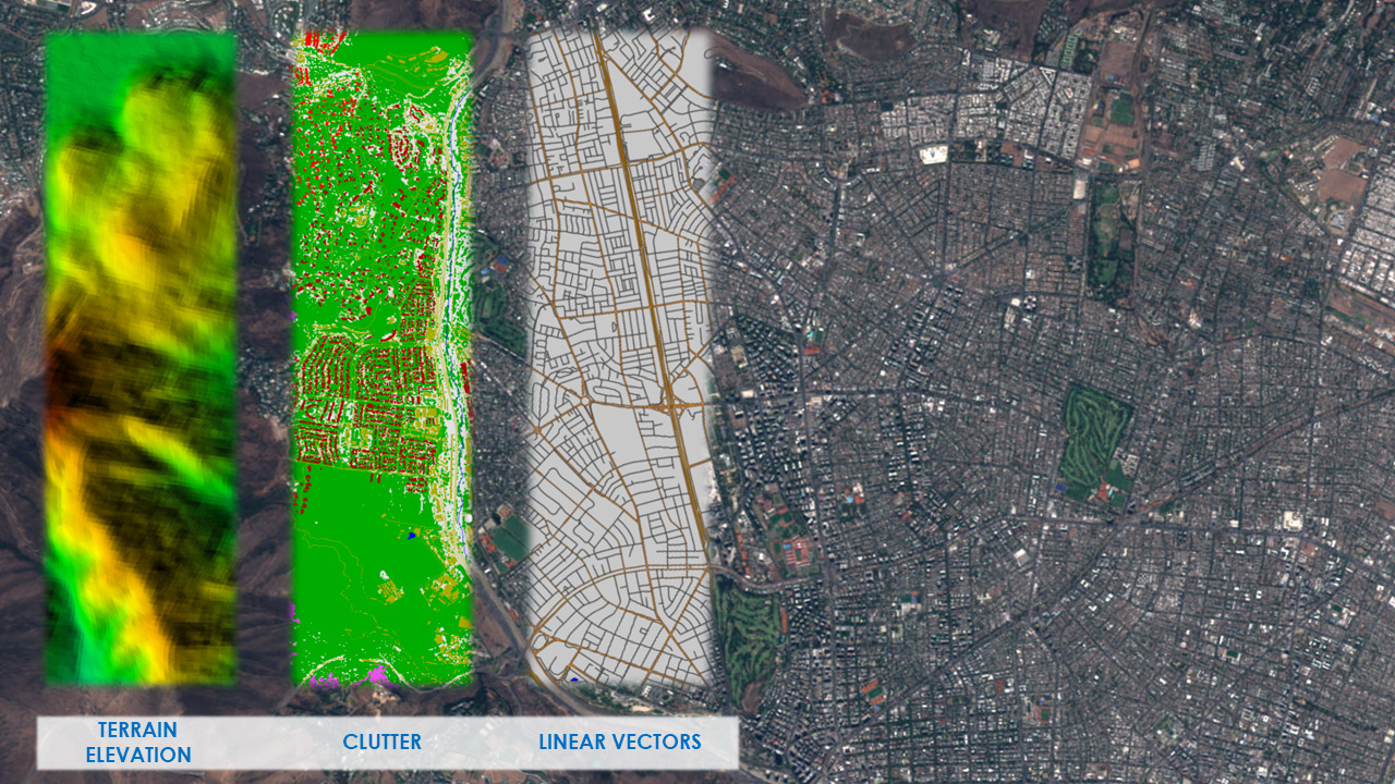
Worldwide coverage
LuxCarta’s Urban Planner 5m can generate datasets for any location worldwide, ensuring you receive high-resolution, detailed mapping with Digital Terrain Models (DTM), land use classifications, and linear vectors, suitable for advanced telecommunications planning in any urban environment.

User-Friendly Integration
Designed for seamless usability, offering geodata in formats compatible with the majority of GIS and telecommunications planning tools. This ensures straightforward integration into your existing workflows, facilitating efficient planning and implementation.

Precision Mapping for RF Analysis: Utilize comprehensive data layers to accurately model RF signal propagation, crucial for determining optimal antenna placement and coverage strategies.

Cost-Efficient Planning: Save significantly by using our comprehensive maps to reduce the need for preliminary fieldwork and initial site visits

Accelerated project timelines: Make informed decisions faster, speeding up the initial phases of network deployment.
.png)