Urban Planner 2.5D
Urban Planner 2.5D
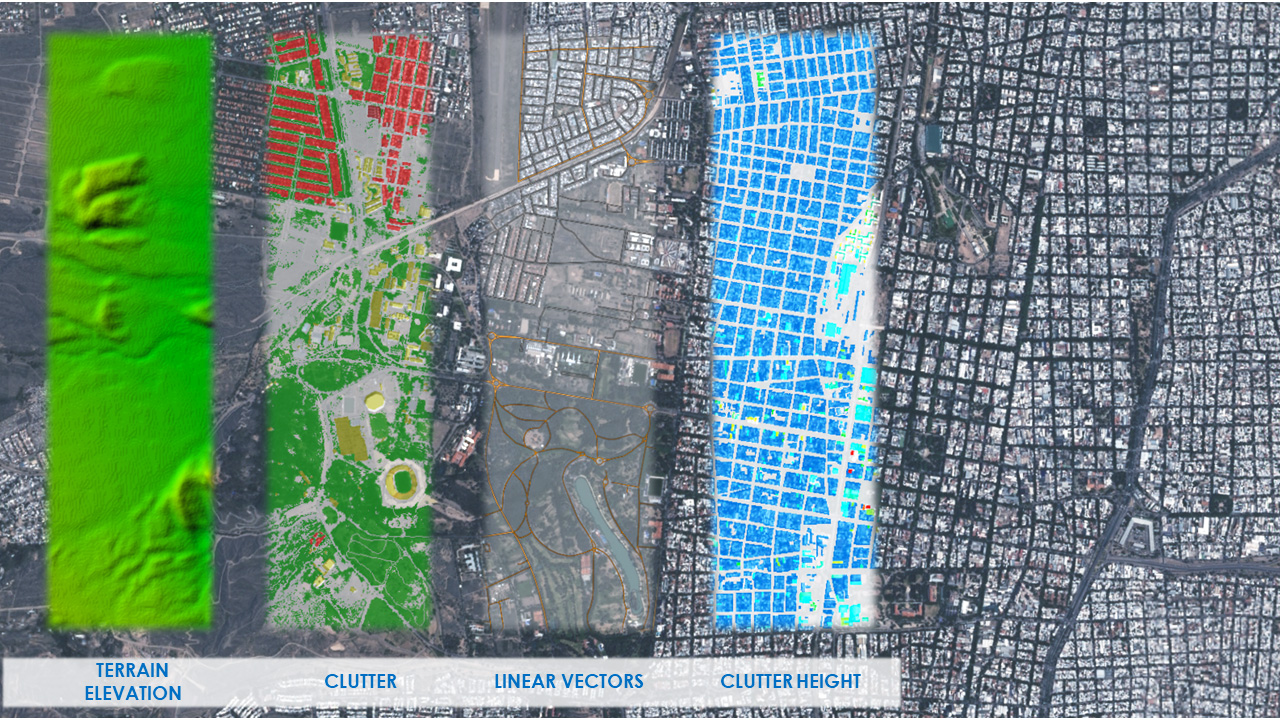
Small Cell Geodata for Suburban Areas. Urban Planner 2.5D is an innovative product that is designed for metropolitan areas where both man-made structures and vegetation play an important role in propagation. An additional building heights raster layer for our Urban Planner data sets provide the missing gap between 2D and 3D geodata when planning in below-clutter morphologies. While it will never replace 3D data in dense urban environments where multiple receiver heights are considered and indoor coverage is critical, Urban Planner 2.5D is ideally suited for small-cell planning outside the dense urban areas of most cities.