
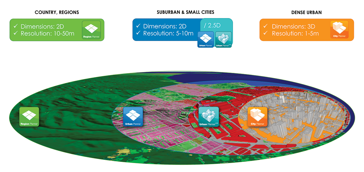

Region Planner
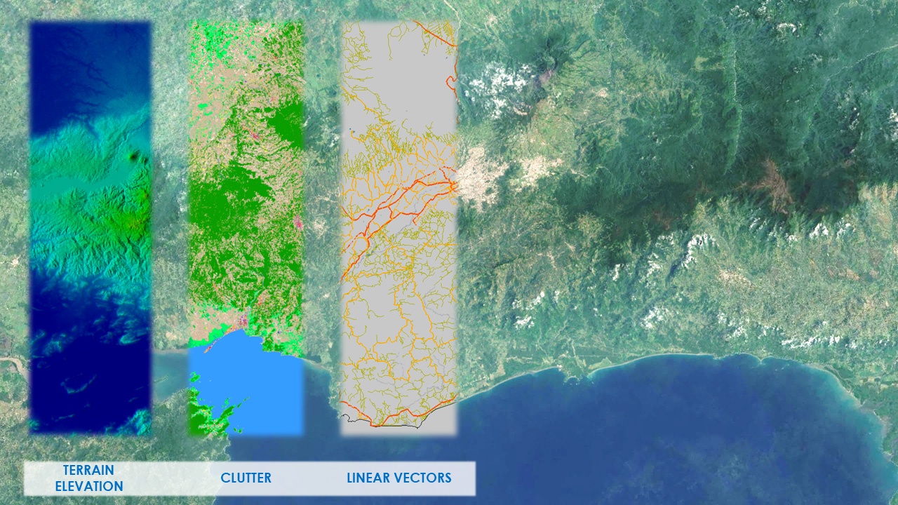
Region Planner medium resolution databases allow you to quickly visualize terrain and clutter over large areas or entire countries. It consists of the following integrated layers: digital terrain model (DTM), clutter, and linear vectors. An orthoimage is also available. Region Planner data sets are designed to be fully integrated with the Urban Planner databases. Application: Bid planning, rural planning.
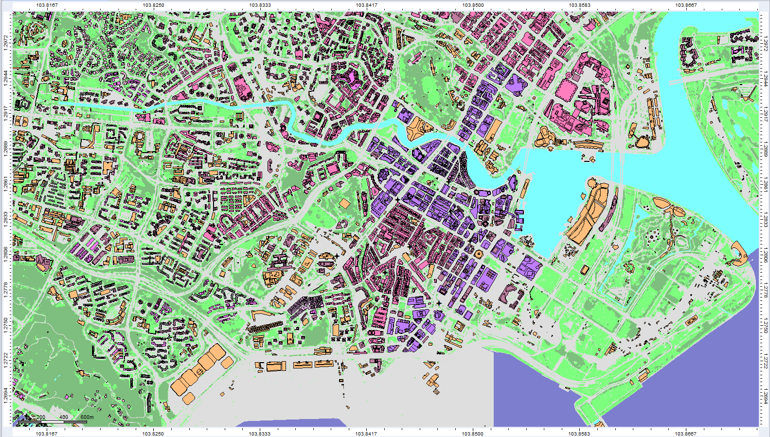
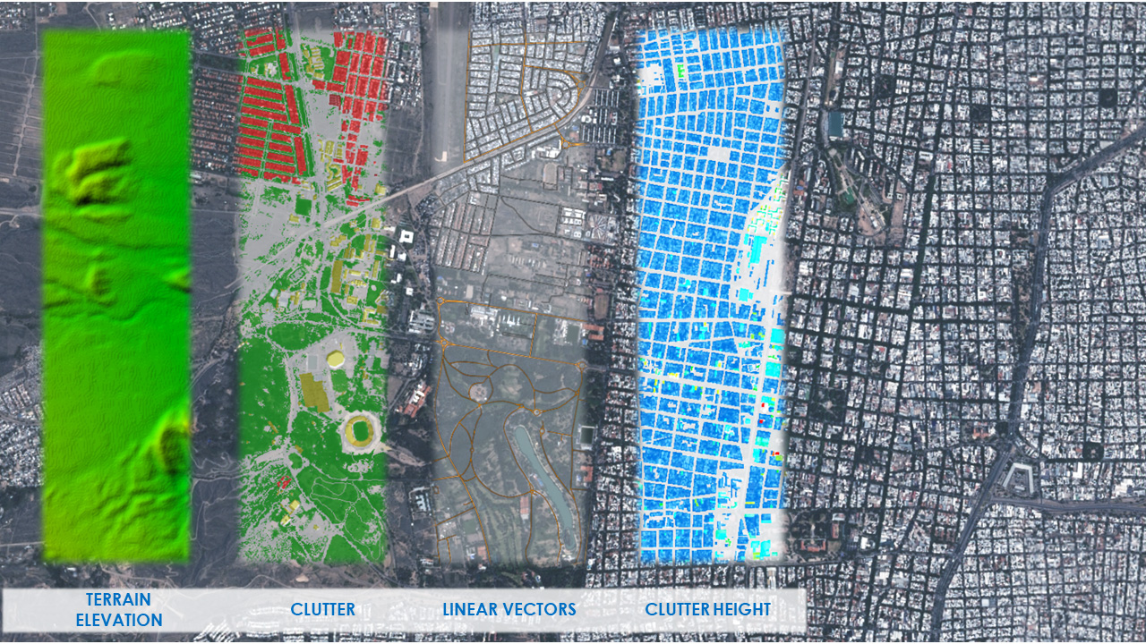
Urban Planner
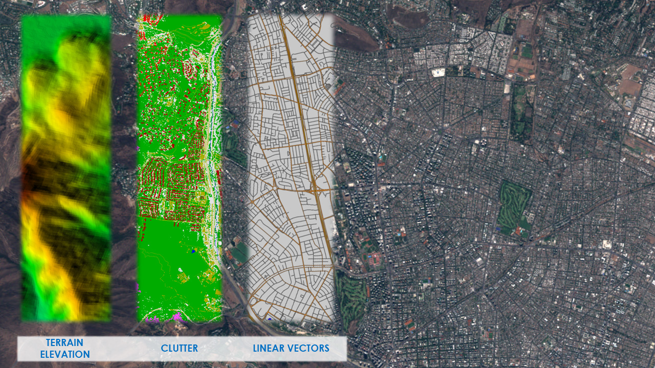
Urban Planner are medium-to-high resolution databases of accurate and up-to-date terrain, clutter, vectors and orthoimagery. It allows for accurate propagation modeling, in 3G and 4G networks.
Urban Planner 2.5D
Small Cell Geodata for Suburban Areas. Urban Planner 2.5D is an innovative product that is designed for metropolitan areas where both man-made structures and vegetation play an important role in propagation. An additional building heights raster layer for our Urban Planner data sets provide the missing gap between 2D and 3D geodata when planning in below-clutter morphologies. While it will never replace 3D data in dense urban environments where multiple receiver heights are considered and indoor coverage is critical, Urban Planner 2.5D is ideally suited for small-cell planning outside the dense urban areas of most cities.
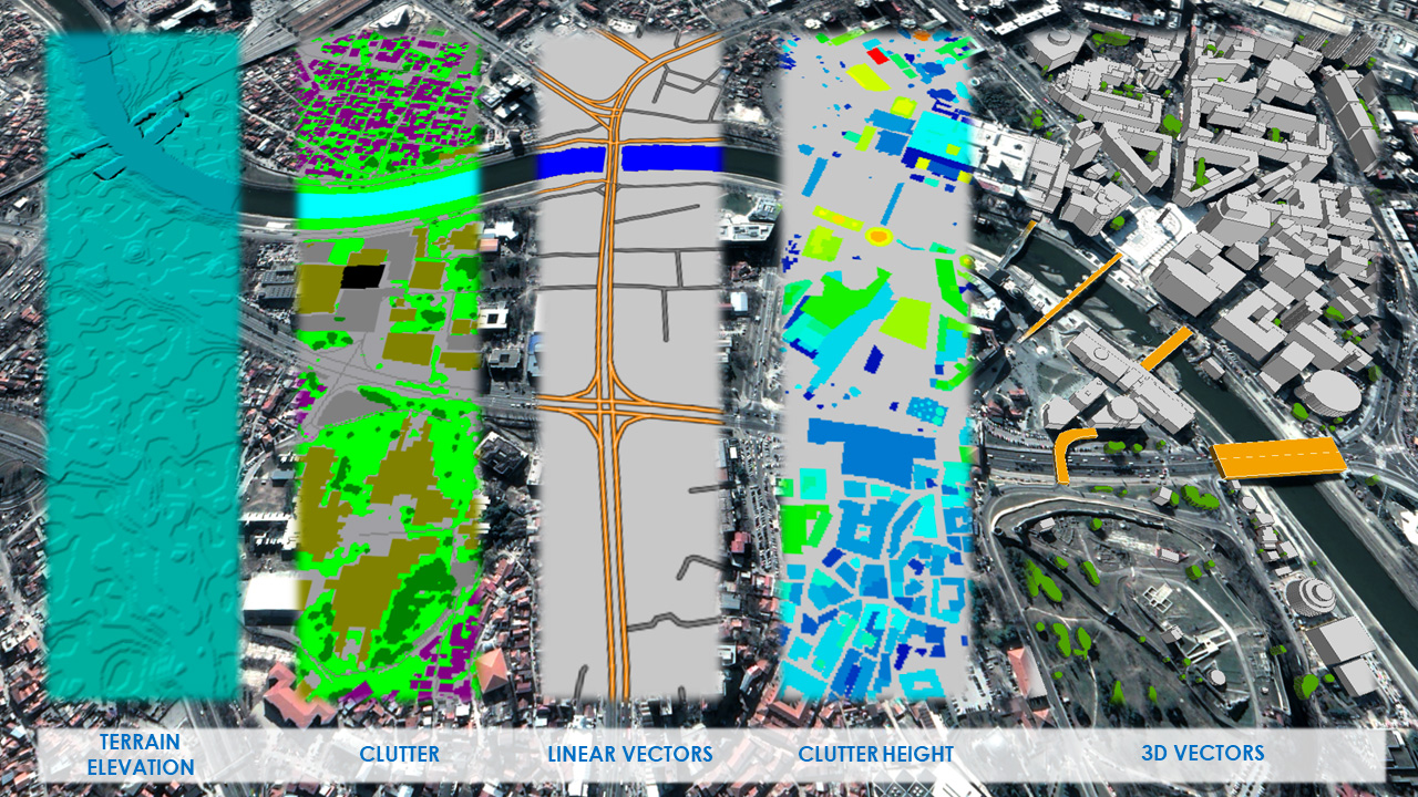
City Planner
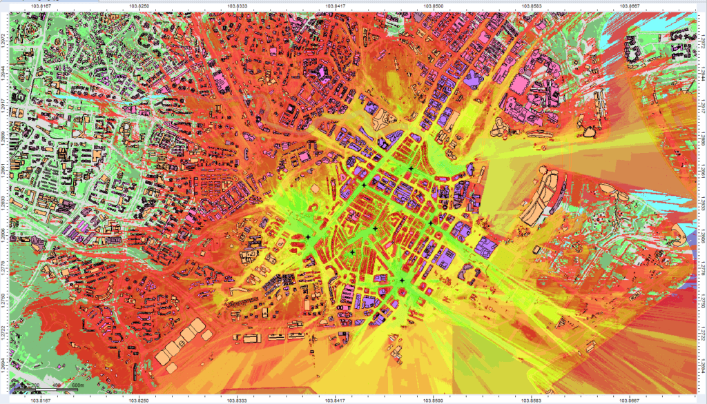
The City Planner is a high resolution database for use in high frequency line-of-sight network applications, and provides an accurate height model of terrain and all above-ground features such as buildings, vegetation and bridges. The integrated orthoimagery provides important planning context and the perfect means of visualizing connectivity to target customers.
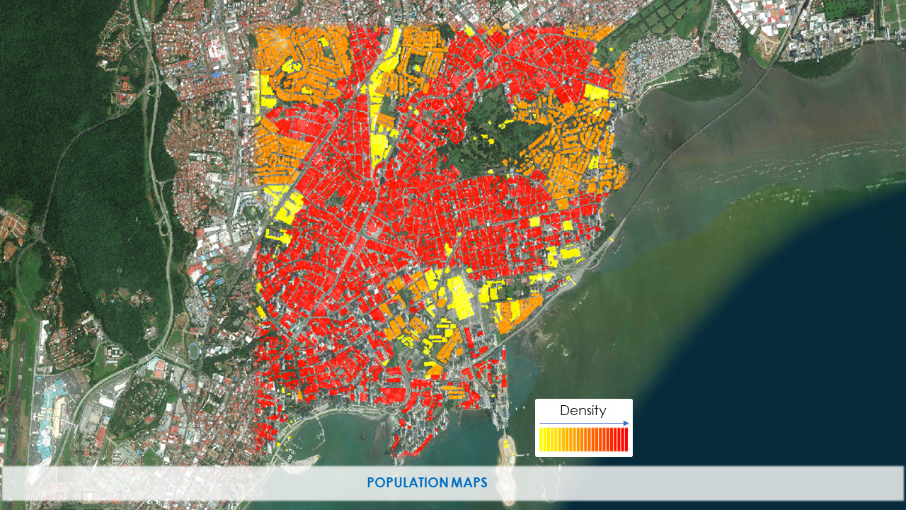
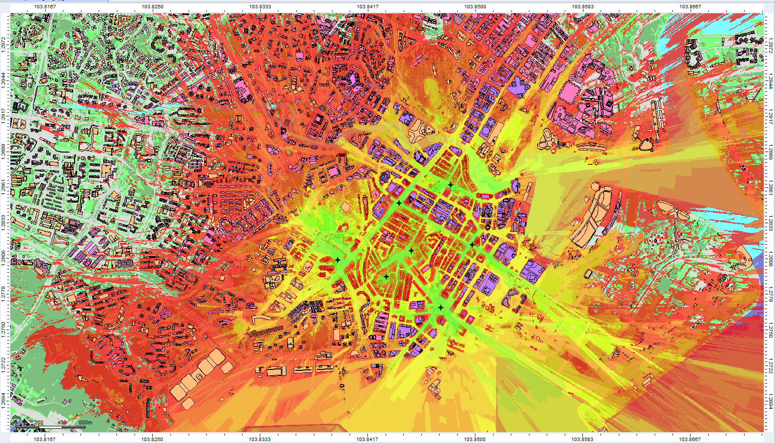
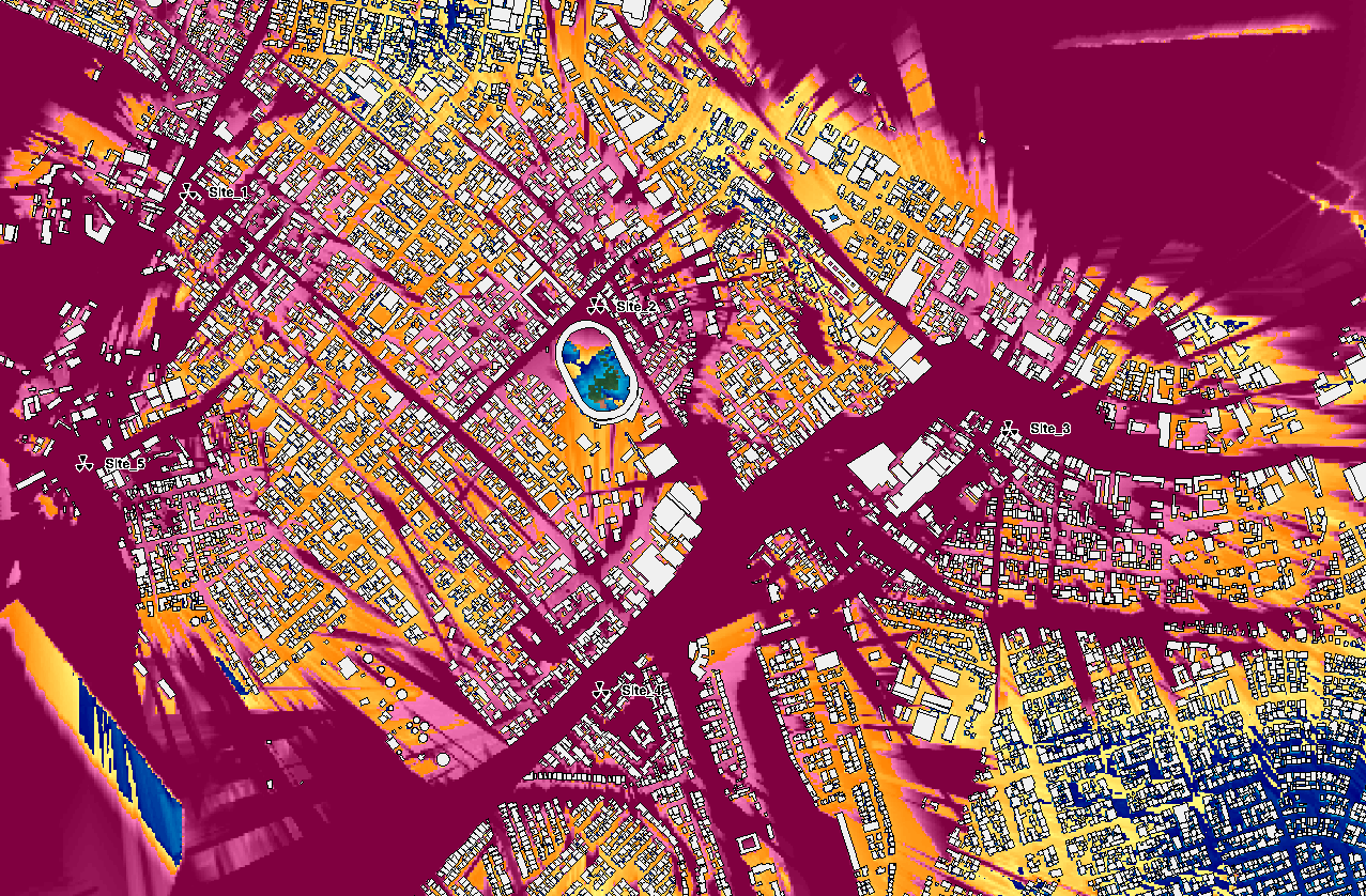
PopMaps
Our updated version of this product, based on extensive R&D within LuxCarta, delivers 1m < 30m population and density maps. It is designed for RF engineers to use when deploying new technologies, performing greenfield planning or optimizing their networks, especially where no historical traffic information is available. PopMaps is provided as an additional layer into LuxCarta Planner geodata sets. Its main use is to identify areas of high traffic demand for expansion and densification of the wireless network.