DTM: Digital Terrain Models for Reliable Ground Surface Data & Simulation
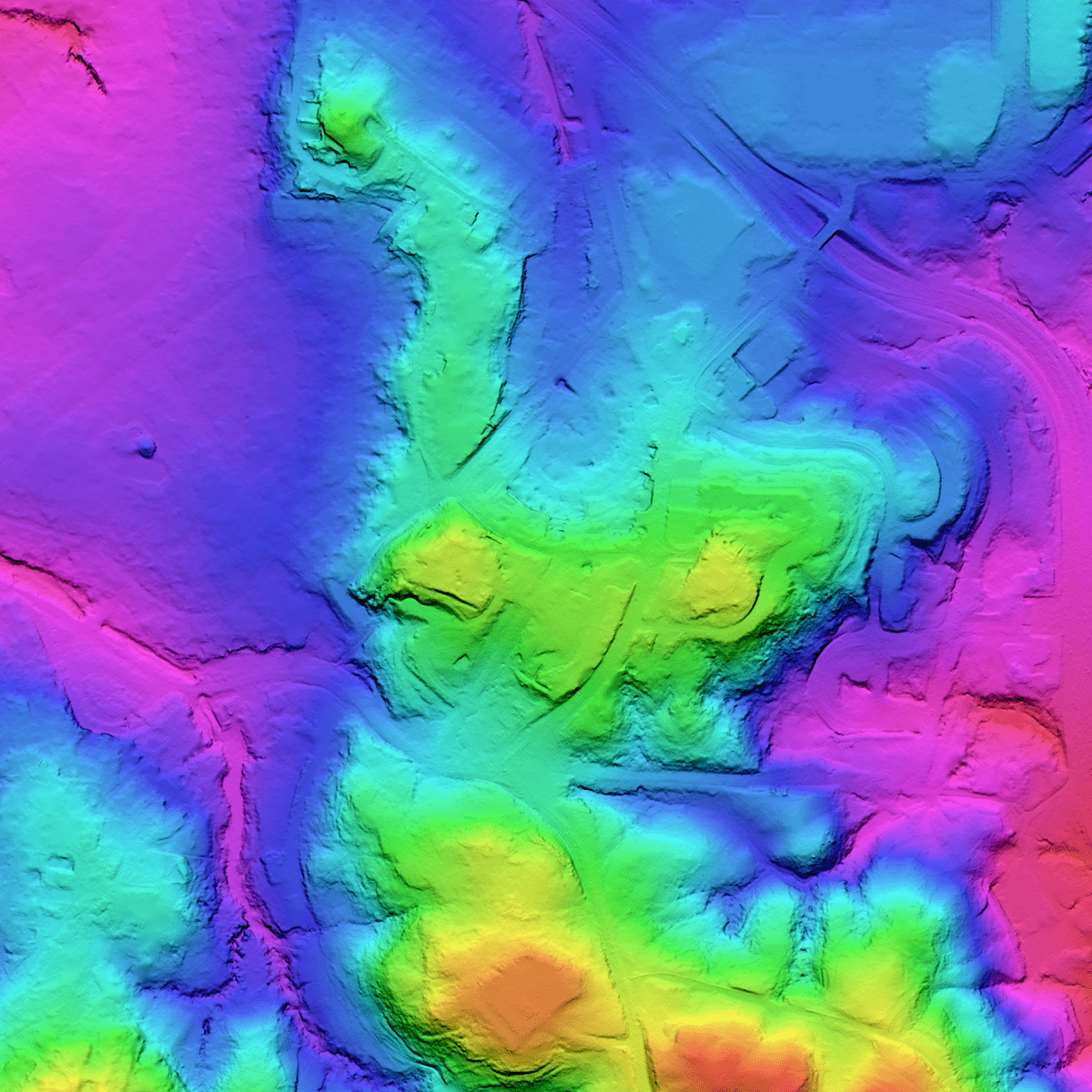
LuxCarta’s DTM provides a clean representation of the Earth’s bare surface
A Digital Terrain Model (DTM) is created by starting with a Digital Surface Model (DSM) and then applying LuxCarta’s proprietary algorithms to remove above-ground features like buildings and vegetation, resulting in a bare-earth surface.
Ideal for simulation, environmental risk modeling, and terrain analysis.

Clean & Reliable Terrain Surface
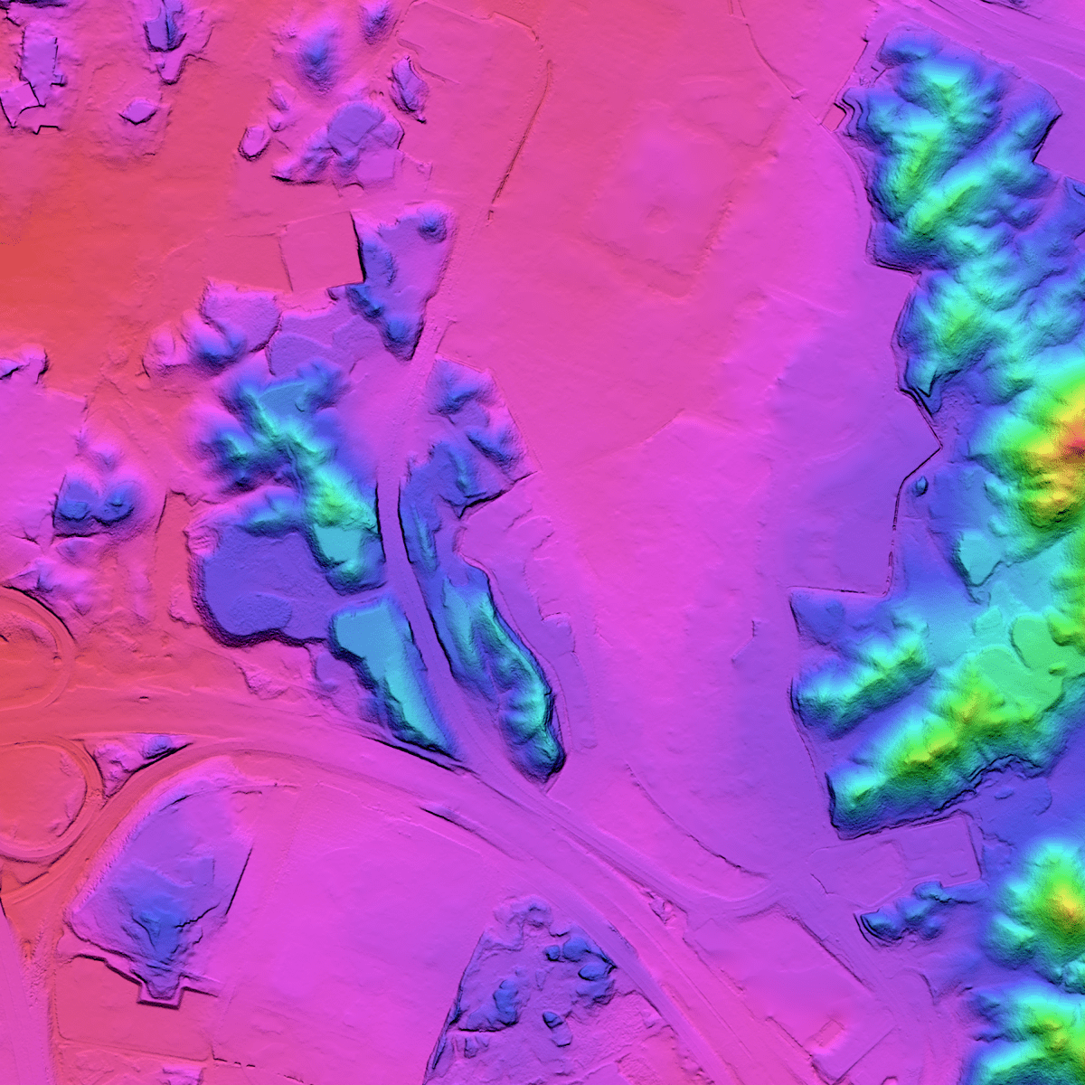
Adjusted Water Surfaces
Water bodies (such as seas, lakes, and large rivers) will be flattened for consistency.

Consistent Global Methodology
Uniform accuracy worldwide
How DTM Works — From Imagery to Bare-Earth Model
Derived from high-resolution satellite imagery, LuxCarta’s DTM delivers bare-earth elevation data with buildings and vegetation removed, ensuring accurate results for telecom, mobility, flood risk, and geospatial modeling.
High-Resolution Imagery Input
The process begins with LuxCarta’s Digital Surface Model (DSM), derived from 30 cm tri-stereo satellite imagery. These images capture terrain, buildings, and vegetation in fine detail, providing the foundation for precise terrain extraction.
Filtering Above-Ground Features
Specialized algorithms and workflows are applied to remove man-made structures and vegetation, isolating only the natural ground surface. This step is crucial in urban and forested environments, where ground visibility is often obstructed.
Water Surface Treatment
Lakes, rivers, and seas are flattened or hydrologically corrected to ensure consistent modeling. Visible river paths are adjusted so that water flows naturally downhill, improving the reliability of hydrological and flood simulations.
Manual Editing & Refinement
Targeted manual quality edits are carried out in complex zones—such as dense forests, urban areas, or steep terrains—where automated processes may miss details. This human validation step guarantees topological consistency and accuracy.
Deliverables Optimized for GIS & Simulation
The final DTM is delivered as GeoTIFF (32-bit float) and optional Shapefiles (SHP), ensuring seamless integration into GIS, CAD, RF planning, and 3D modeling platforms. This compatibility allows engineers, urban planners, and researchers to immediately incorporate DTM data into their workflows.
Applications
LuxCarta’s DTM delivers clean, bare-earth terrain data that engineers and telecom operators rely on to plan, model, and optimize projects with confidence.
Line-of-Sight & Terrain Obstruction Analysis
Model ground-level visibility and obstacle-free zones to support telecom, defense, and sensor-based planning.
3D Synthetic Terrain for Training & Simulation
Support defense, emergency response, and virtual environments with accurate ground-only elevation inputs.
Urban Planning & Elevation-Conscious Design
Support zoning, building placement, and infrastructure planning in elevation-sensitive urban environments.
Integrate your Population Density Map With All Planning Technology
List of Integrations: Information on software, tools, and services that the product integrates with, enhancing its utility and flexibility.
Integration Details: Brief explanations of how each integration adds value to the user experience.
Testimonials and Case Studies
Learn how global telecommunications firms are benefiting from LuxCarta’s unique population density map solution.
“We needed a way to show our senior leadership team that marketing was producing results, and that’s hard when your metrics are scattered. This dashboard saved the day.”
“We needed a way to show our senior leadership team that marketing was producing results, and that’s hard when your metrics are scattered. This dashboard saved the day.”
Frequently Asked Questions
Explore the most common questions about Digital Terrain Models (DTM) and how LuxCarta’s solutions support 5G planning, flood risk assessment, and infrastructure modeling.
What is a Digital Terrain Model (DTM)?
A Digital Terrain Model is a bare-earth elevation dataset with vegetation, buildings, and infrastructure removed. It differs from a DSM, which includes above-ground features. DTM is essential for flood analysis, mobility simulation, and RF planning, where only the ground surface matters.
How accurate is LuxCarta’s DTM?
Derived from 30 cm tri-stereo imagery, DTM offers <0.1 m RMSE with GCPs and ~<1 m RMSE without GCPs. This level of accuracy ensures reliable outputs for 5G network planning, flood modeling, and engineering simulations.
How long does it take to deliver a DTM?
Delivery is typically ~4 weeks after order confirmation, depending on the Area of Interest (AOI). Final outputs are provided in GeoTIFF format, ready to use in GIS and modeling tools.